Prince William Conservation Alliance
 
Home About Us Calendar Resources Donate

Back to Trails
2002 Implementation Plan for the PHNST in Prince William County - NoVA Regional Commission (8.4 mb pdf file)
PWC - Stafford County Line to Rippon Landing VRE Station: Property Ownership Status for Recommended & Alternative Trail Corridors
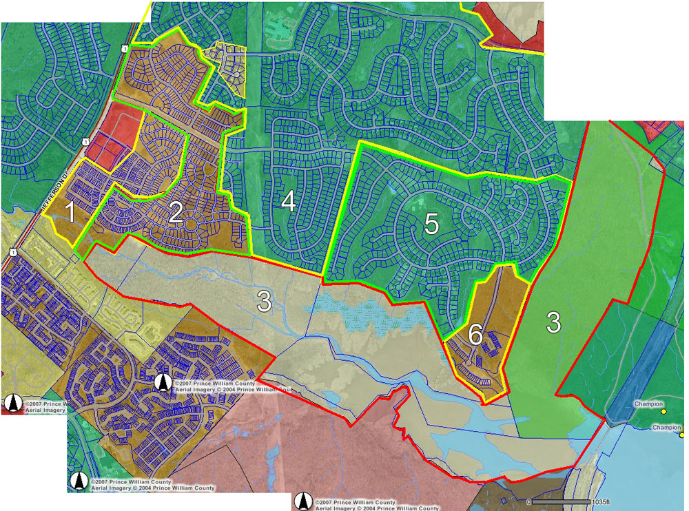
Adjacent Properties to the Powell's Creek Trail - Rezoning Information
Powell's Creek Trail Staff Report; June 9 2007
Comments from PWC Watershed Management
Powell's Creek Trail Segment Map from the Rivers & Trails Conservation Assistance Program
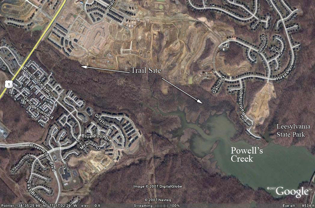
Powell's Creek Watershed
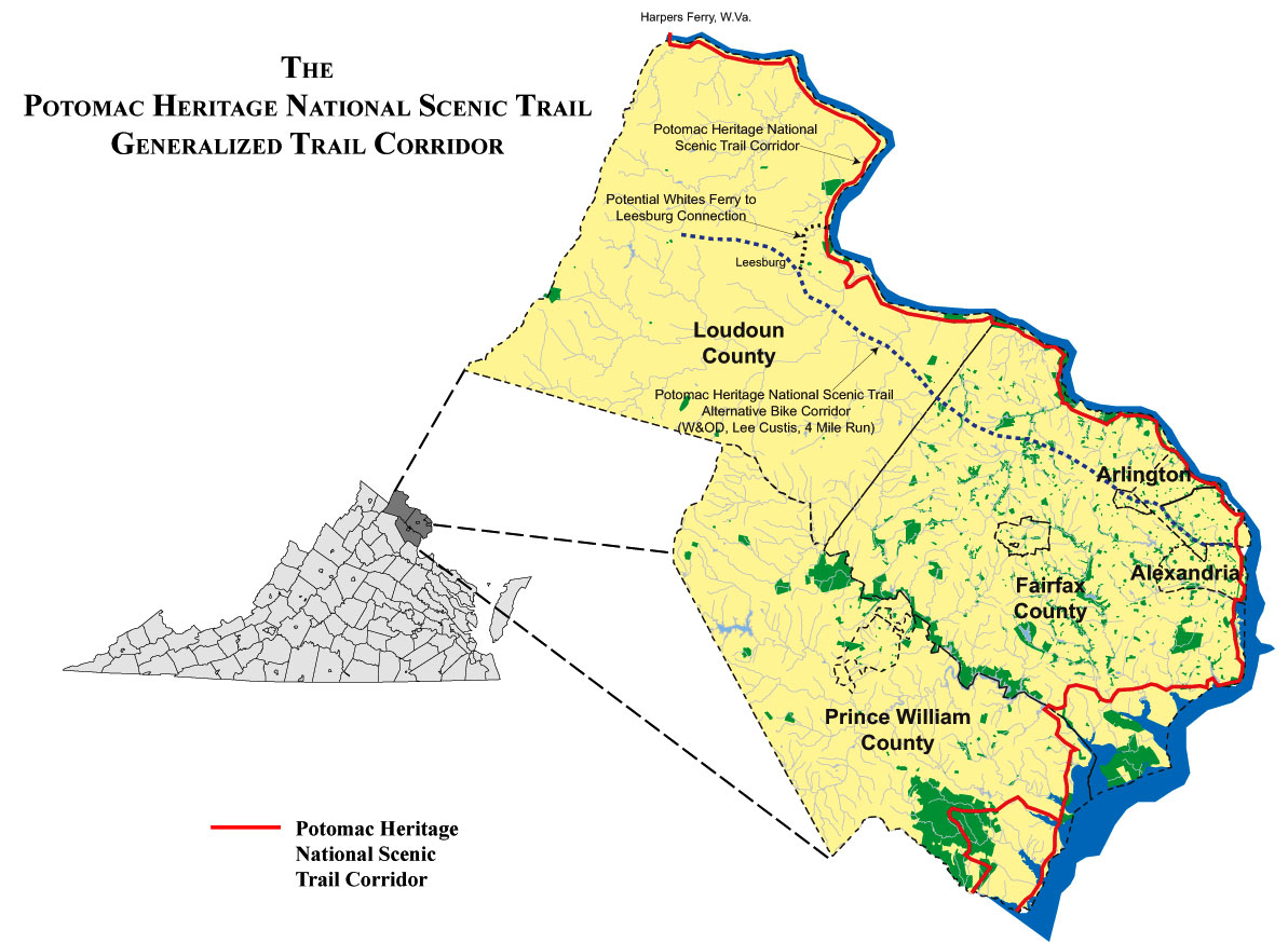
Northern Virginia Generalized Corridor Map
Potomac Heritage National Scenic Trail Map (2005)
National Trails System Map
2002 State of the Trail Report
Great Allegheny Passage: 150-mile system of biking and hiking trails connecting Cumberland, MD & Pittsburgh, PA.
Mount Vernon Trail: 18.5-mile trail from Mount Vernon to Theodore Roosevelt Island in the Potomac River.

Potomac Heritage National Scenic Trail

PHNST Northern Virginia CorridorThe Potomac Heritage National Scenic Trail (PHNST) is one of the 24 Congressionally-designated trails in the National Trails System. The PHNST offers Virginia communities signficant opportunities to enhance existing recreational amenities, leverage heritage tourism and economic benefits, expand non-motorized transportation networks, preserve natural areas, create educational and interpretive experiences, connect neighborhoods, historic sites and parkland, and rebuild community connections.

The Trail in Prince William County

In Prince William County, the Recommended Shoreline Alignment would connect Locust Shade Park, Prince William Forest National Park, Leesylvania State Park, Metz Wetland Bank, Featherstone National Wildlife Refuge, the Occoquan Bay National Wildlife Refuge and Veteran's Park.

July 12 2007 UPDATE:
Powell's Creek Trail:
Potomac Heritage Trail Critical Connection


Powell's Creek Trail LocationPlanning Commission Review and Vote
on the Public Facility Review for the proposed Powell's Creek Scenic Trail segment of the Potomac Heritage National Scenic Trail from Route 1 to Leesylvania State Park, through the Port Potomac community and County-owned property.

WHEN: Wednesday, July 18 at 7:00 p.m.
WHERE: McCoart Government Center on PW Parkway , directions

The Planning Commission vote is the final decision on Public Facility Reviews. Applicants have the right to appeal a denial to the Board of Supervisors.

Recap below; click here to read the staff report. Click here to email all Planning Commissioners.  Click here to email the Park Authority Board.

The Powell's Creek Trail:

  1. Should ensure connectivity to the regional Potomac Heritage Trail.

  2. Should ensure broad public access in addition to access to members of the Port Potomac Homeowners Association;

  3. Include construction standards that minimize maintenance costs (current plan proposes a woodchip trail through wetlands & other flooded areas);

  4. Commit to construction of all needed boardwalks through wetlands and floodplain (including the flood hazard zone), which could be needed for more than 50% of the trail corridor. Currently boardwalks are proposed for less than 4% of trail length. Should the developer remain unwilling to provide the additional boardwalks, the County should acknowledge the need for additional boardwalk and commit to add this project into the Capital Improvement Project budget.  

  5. Ensure that the construction of the trail minimizes long-term maintenance costs, which will be the responsibility of the PWC Park Authority.

The current proposal includes no guarantees that the Powell's Creek Trail will connect to the Potomac Heritage National Scenic Trail. Without connections, public access to this trail would be largely limited to residents of the Port Potomac development/HOA.

  • This segment of the approved generalized corridor for the Potomac Heritage Trail travels east along Powell's Creek, and connects Leesylvania State Park to Prince William Forest Park.

  • The County has been working without success for more than five years to secure the critical connections needed to complete this segment of the Potomac Heritage Trail. Currently the eastern boundary of the Powell's Creek Trail cannot connect to Leesylvania State Park . The western boundary ends at Route 1, where the County has no plans to complete pedestrian access across this major road to ensure safe passage for trail users.   

  • With no connection to the regional Potomac Heritage Trail in place, the only public access point to this trail is from Route 1, where trails users would be required to park in an unspecified parking lot and walk along the road to the trail entrance.

  • Without connections to the Potomac Heritage Trail in place, access to the Powell's Creek Trail would be largely limited to residents of the Port Potomac community but maintained by the PWC Park Authority using public tax dollars.

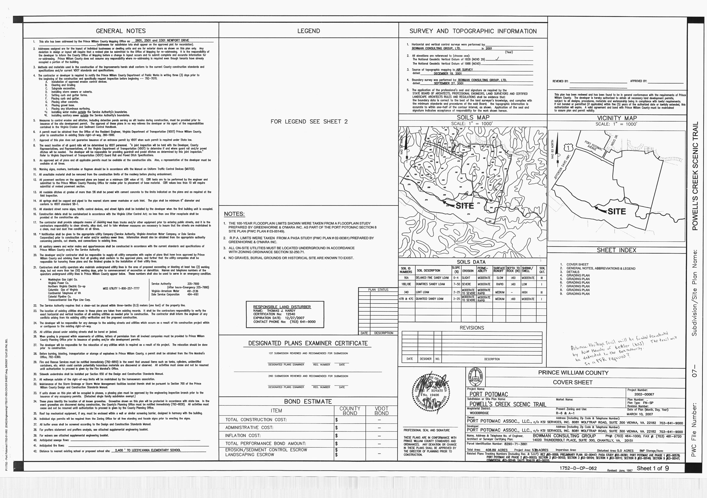
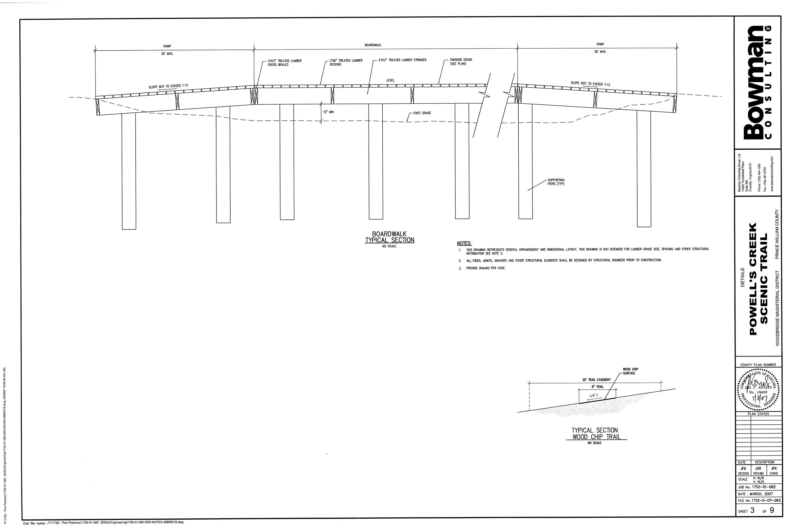
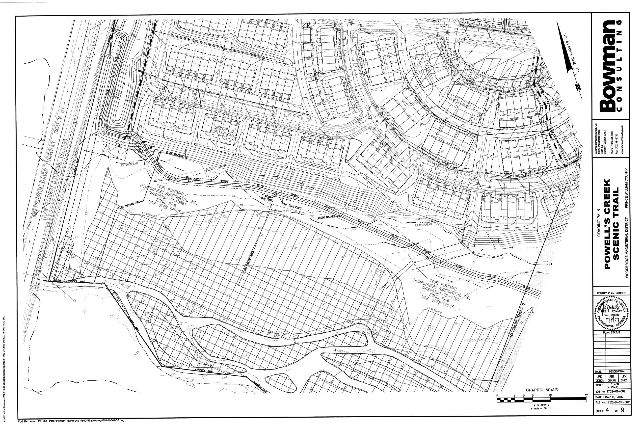
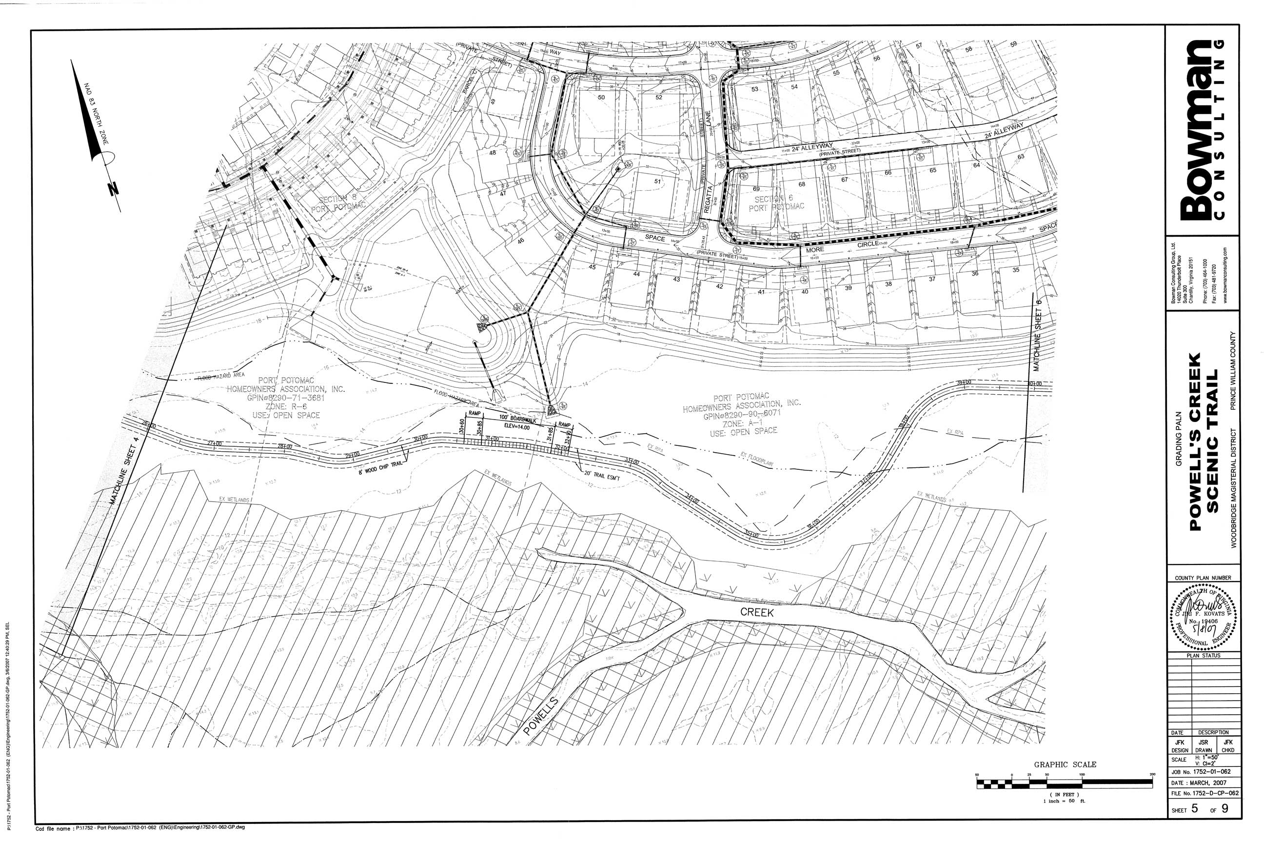
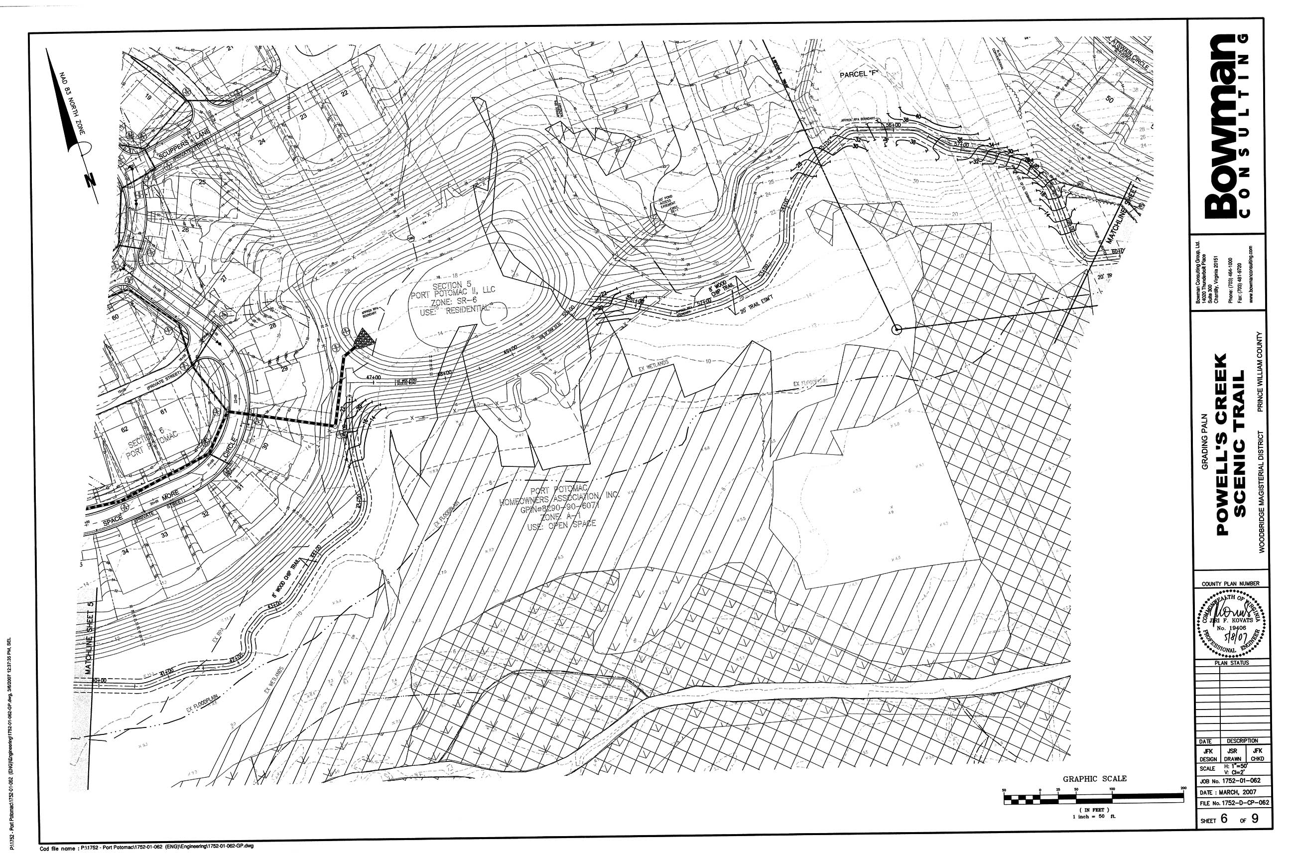
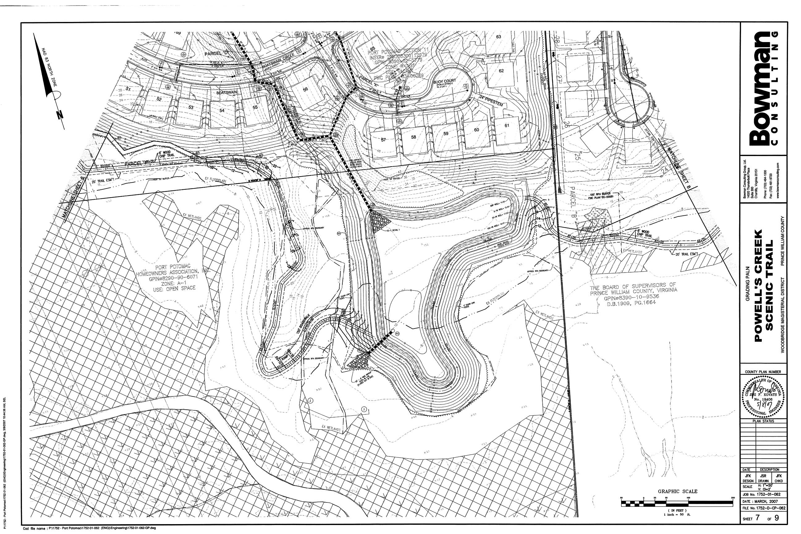
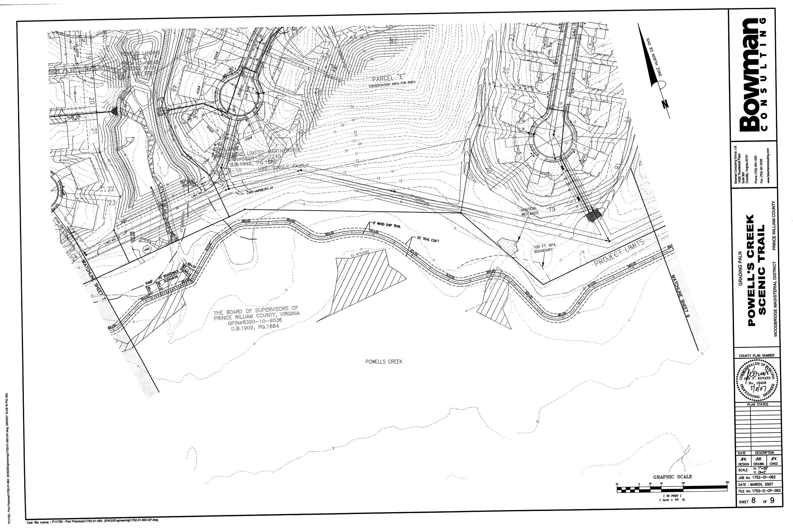
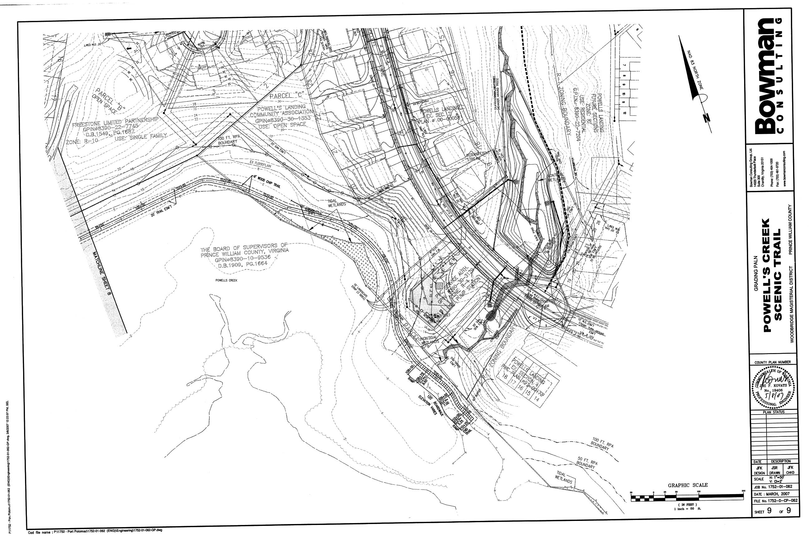
The proposed Powell's Creek Trail travels along tidal and nontidal wetlands, crosses a wetland and a very large percentage lies within the floodplain, including the flood hazard zone. The proposed trail appears to be more than 9,000 feet, but only 325 feet would be constructed as a boardwalk and the remainder would be a wood chip trail. Although wood chip trails can minimize environmental impacts in the right areas, boardwalks are often more appropriate in areas that are routinely saturated (such as at Huntley Meadows in Fairfax). Wood chips tend to migrate under foot traffic and they also float away, which increases maintenance costs as well as environmental impacts. 

Proposed Powell's Creek Trail Plan:

Sheet 1 - Cover Sheet, General Notes
Sheet 2 - Legend, General Notes & Specifications, E&S Information

Sheet 3 - Boardwalk Criteria

Sheet 4 - Grading Plan

Sheet 5 - Grading Plan

Sheet 6 - Grading Plan

Sheet 7 - Grading Plan

Sheet 8 - Grading Plan

Sheet 9 - Grading Plan

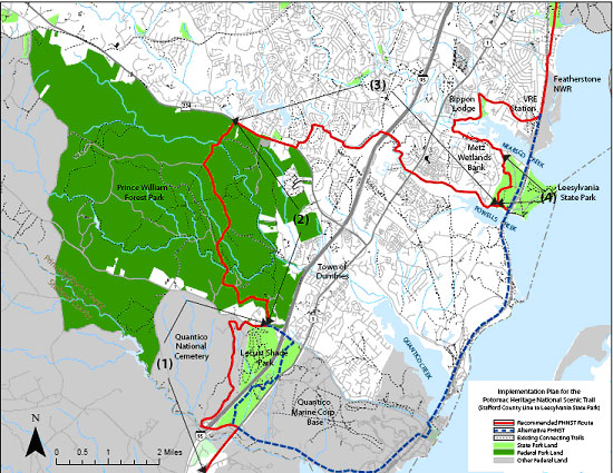
The County requested assistance from the Rivers, Trails & Conservation Assistance Program for this segment of the PHNST, who provided a map showing the trail alignment. Click here to view the RTCAP map.

Northern Virginia Regional Commission's Implementation Plan for the PHNST in Prince William County:

Adjacent Properties - Rezoning Information:Powell's Creek Land Uses


1 -- REZ1995-0008 - Proffers
2 -- REZ1993-0010 - Proffers
3 -- REZ1958-0000 - No Proffers
4 -- REZ1958-0040 - No Proffers
5 -- REZ1980-0059 - Proffers
6 -- REZ1988-0023 - Proffers


Home | Upcoming Events | About Us |Join | Resource Issues | News | Report Violations
Maps | Photos | Publications | Youth Education |FAQ's | Links | Membership