Maps
Click on names below to view maps.
See
Other Sources of Prince William Maps
as well.
Agricultural and Forestal Districts in Prince William County
Bluebird Trails
Chinn Park
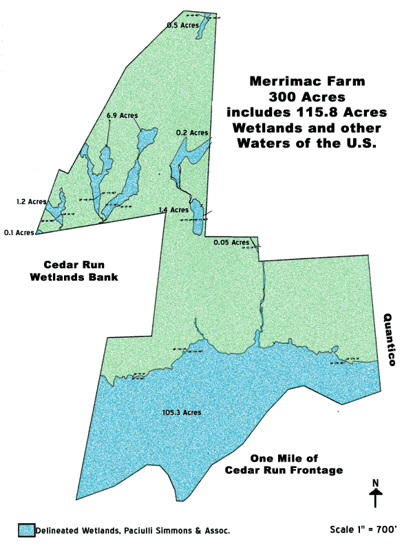
Merrimac Farm
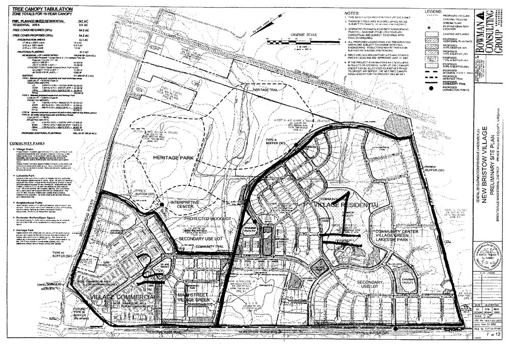
Bristoe Station Site Plan
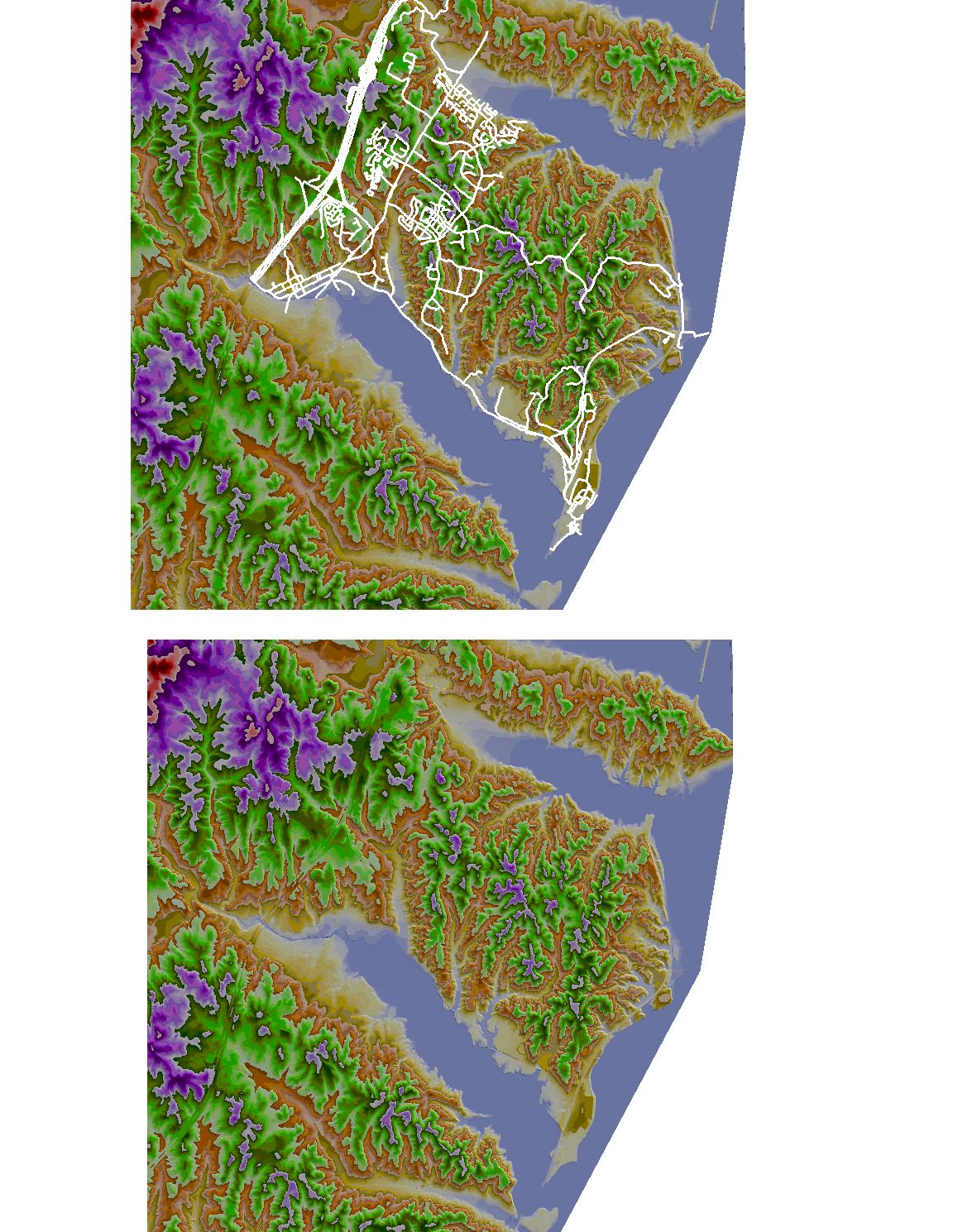
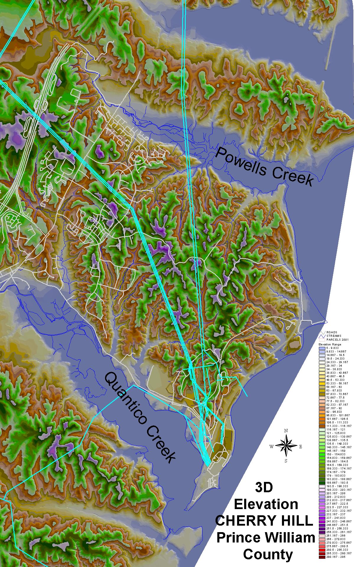
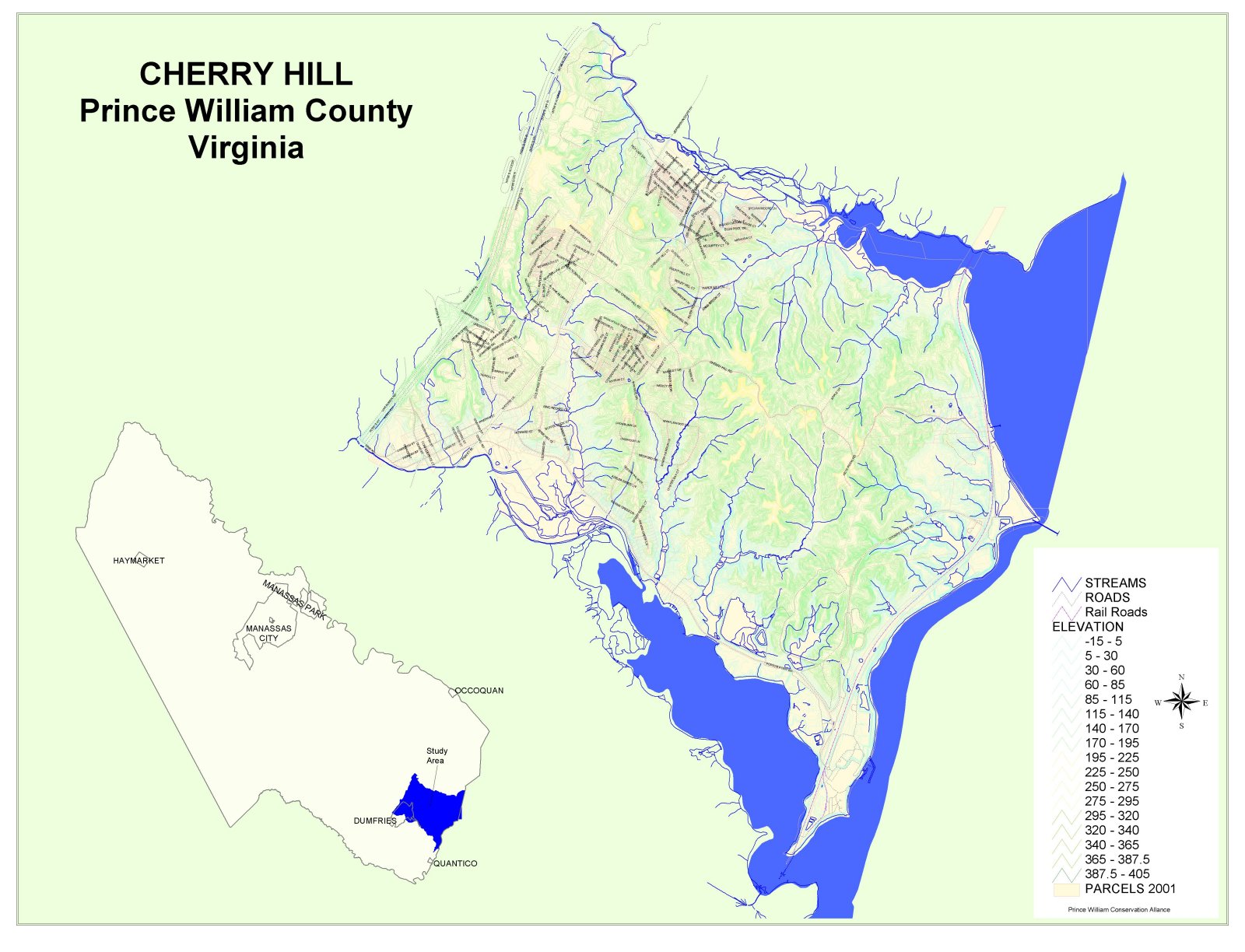
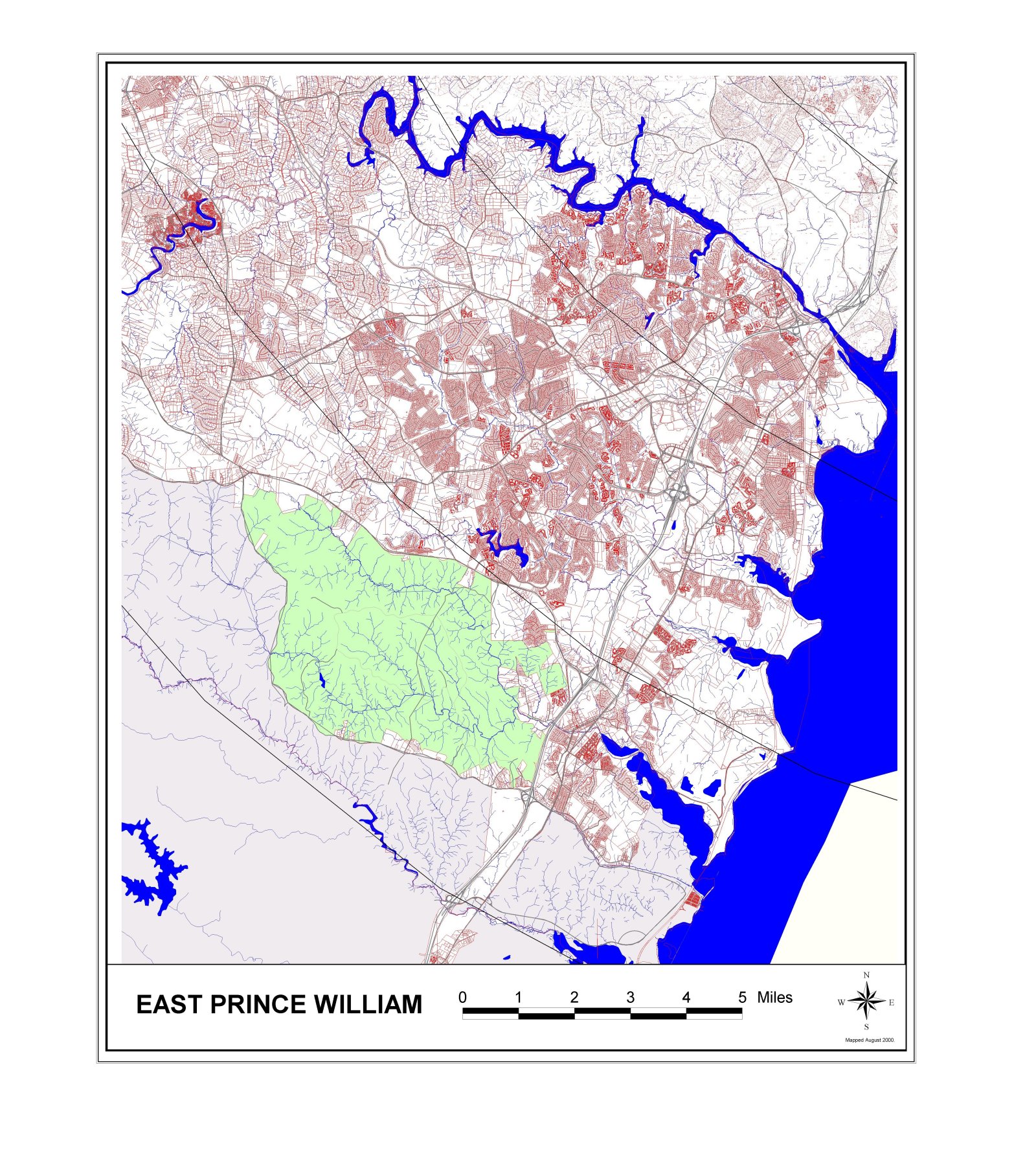
Cherry Hill Peninsula
Cherry Hill
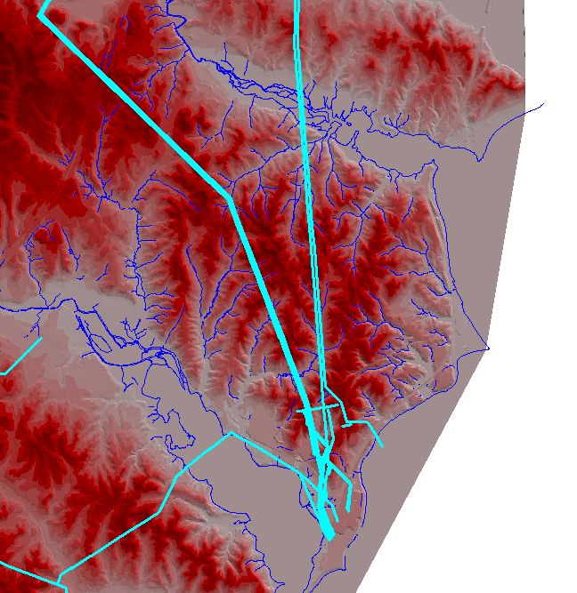
Cherry Hill/Possum Point utility corridors
Cherry Hill
(large version)
Cherry Hill topographic map
Cherry Hill topographic map, v2
Christmas Bird Count - Nokesville Count Area
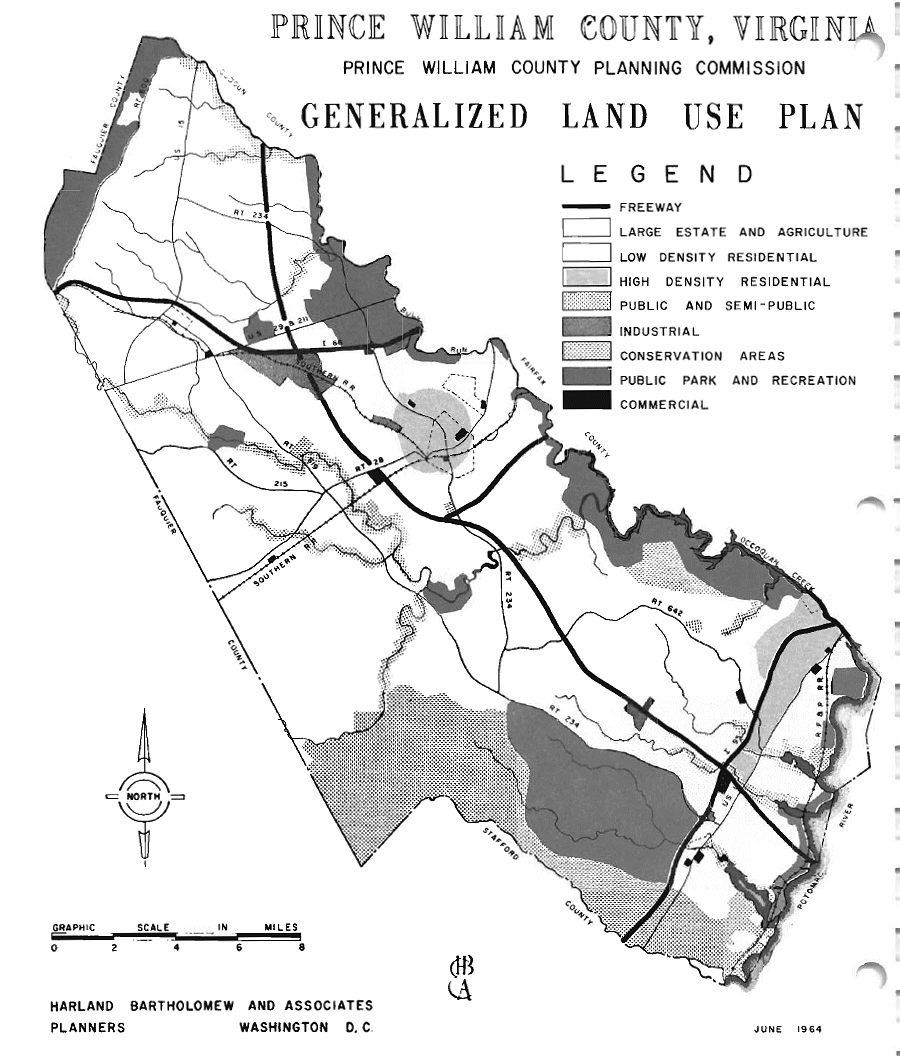
Comprehensive Plan - Prince William County Long-range Land Use
1964
1991
2009
Comprehensive Plan Maps - Prince William County
Future Transit Alternatives Map
Open Space - 2008
Chesapeake Bay Resource Preservation Areas - 2008
Highly Erodible Soils - 2008
Highly Permeable Soils - 2008
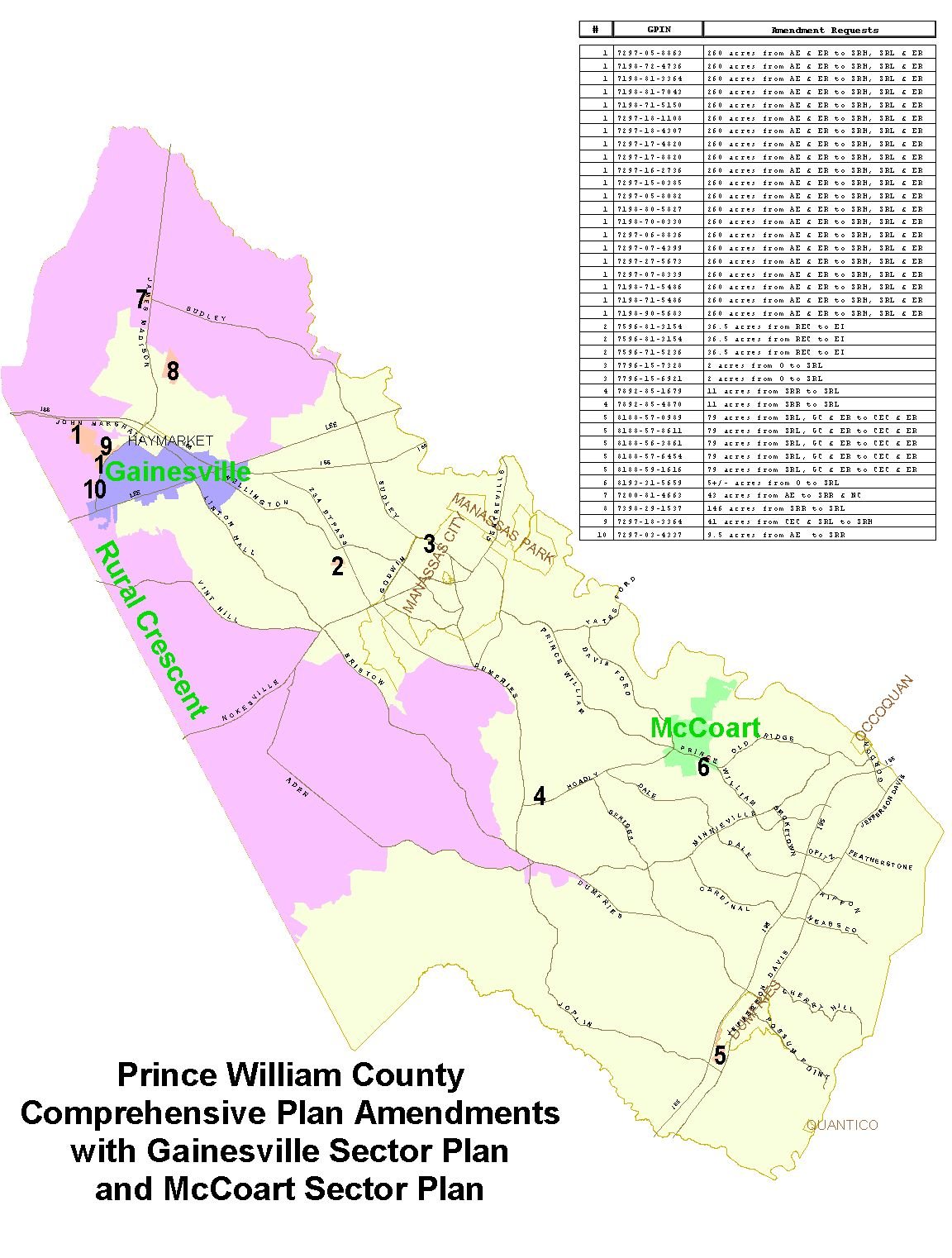
Comprehensive Plan Amendments - Gainesville and McCoart Sector Plans
Conservation Lands - Virginia Dept. of Conservation and Recreation
Drinking Water
Percentage of Surface Drinking Water from Intermittent, Ephemeral, and Headwater Streams in Virginia
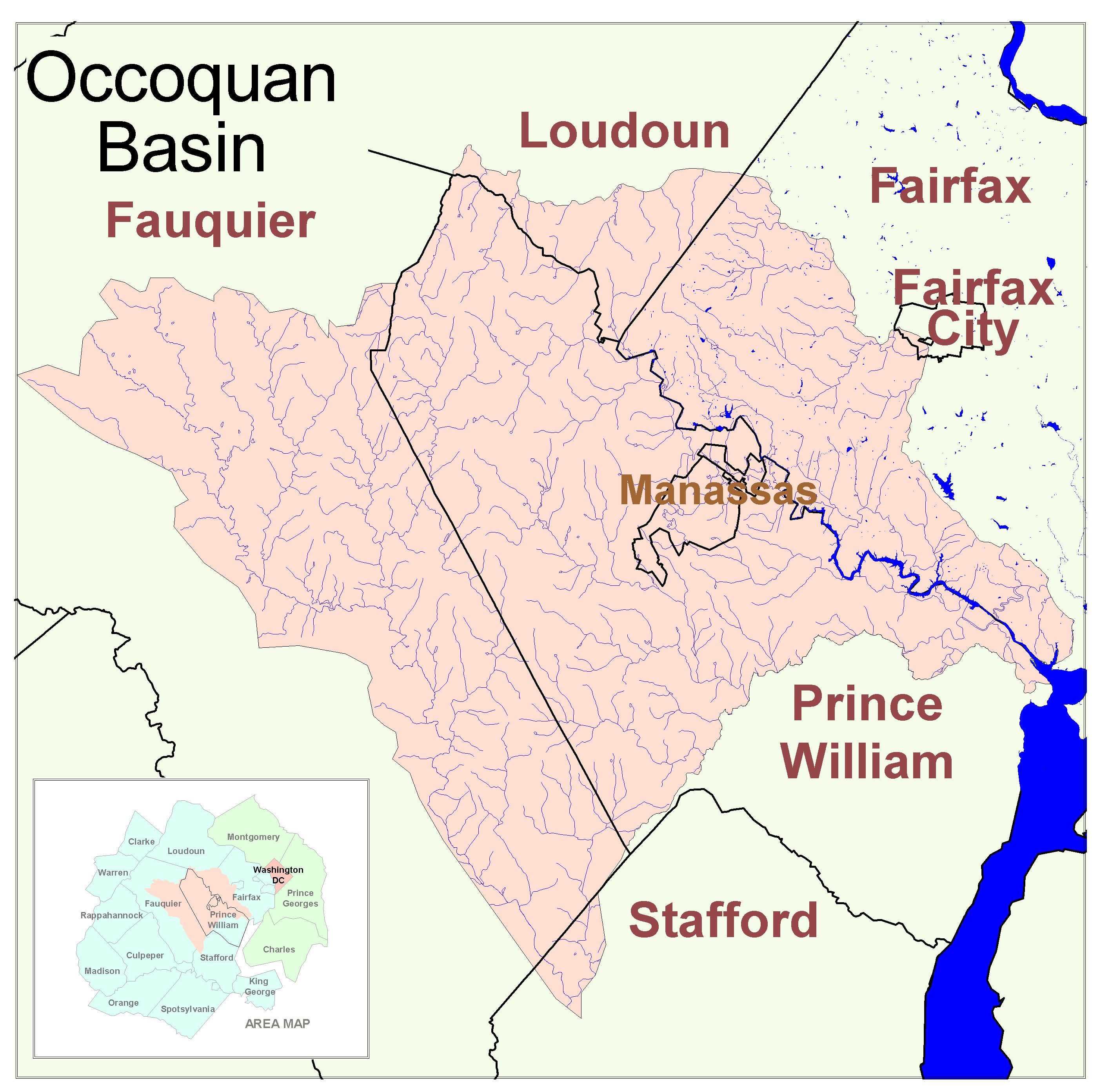
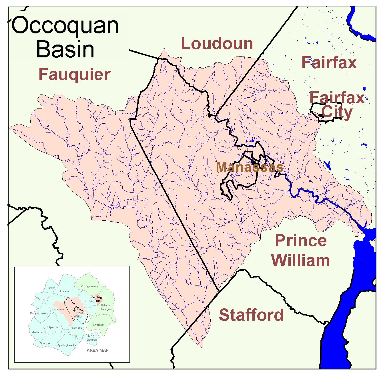
Occoquan Basin
Occoquan
(large version)
Occoquan 2
New York City's Drinking Water Supply
Data Centers
Data Centers Overlay Showing Additional Area
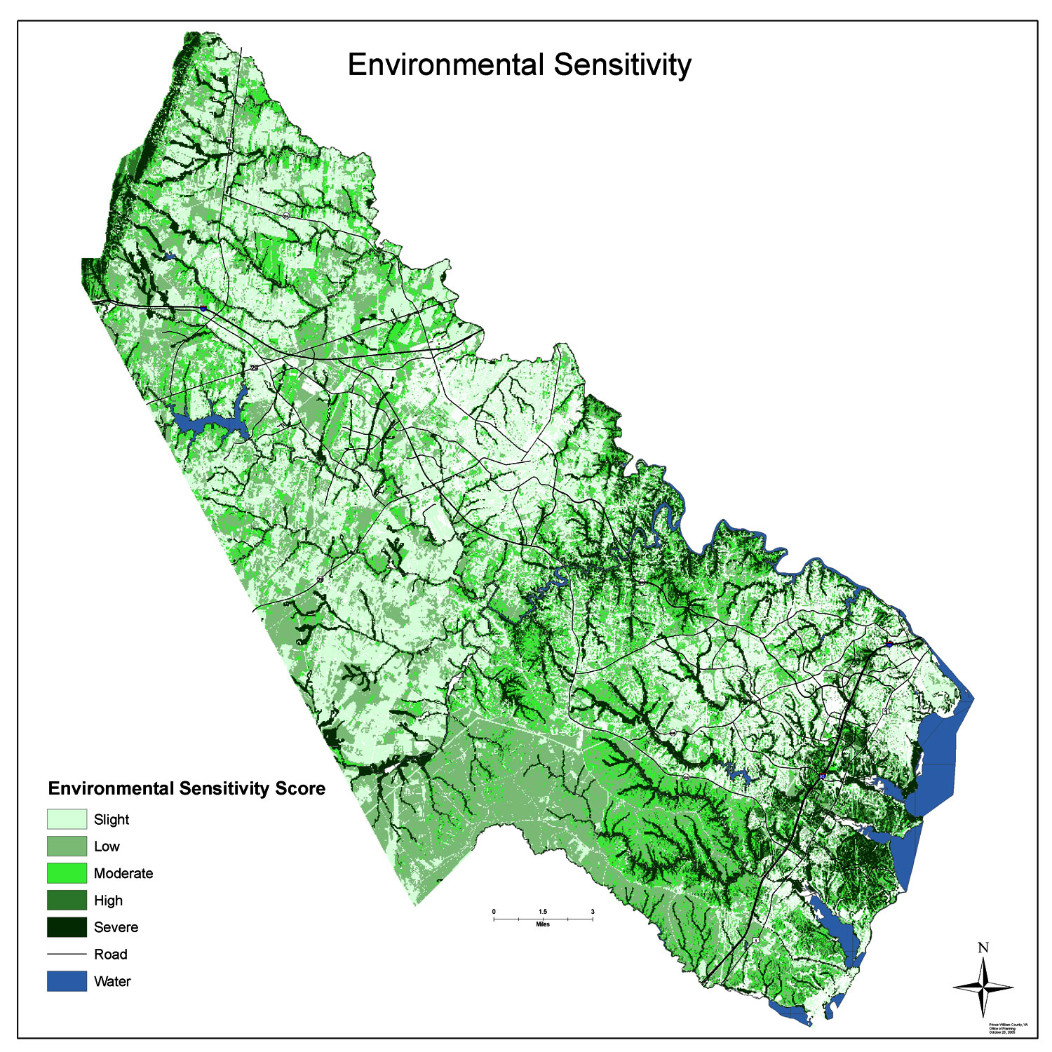
Environmental Sensitivity - Prince William County, 2007
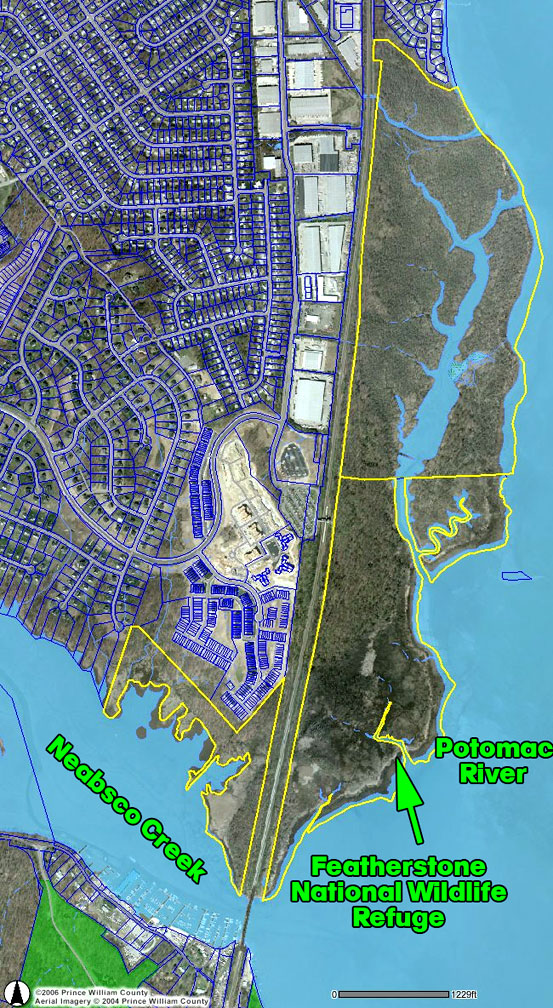
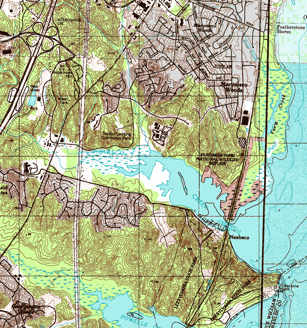
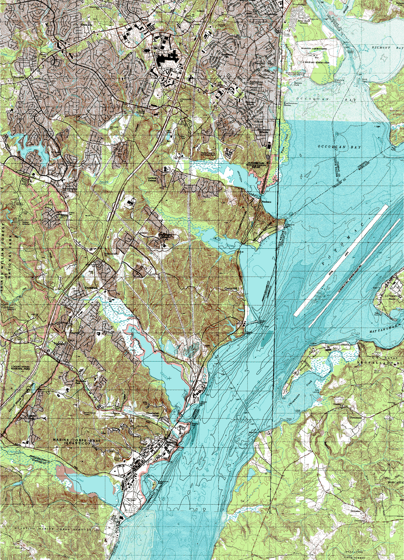
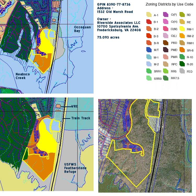
Featherstone Refuge
Featherstone National Wildlife Refuge - Aerial
Featherstone National Wildlife Refuge - Topo
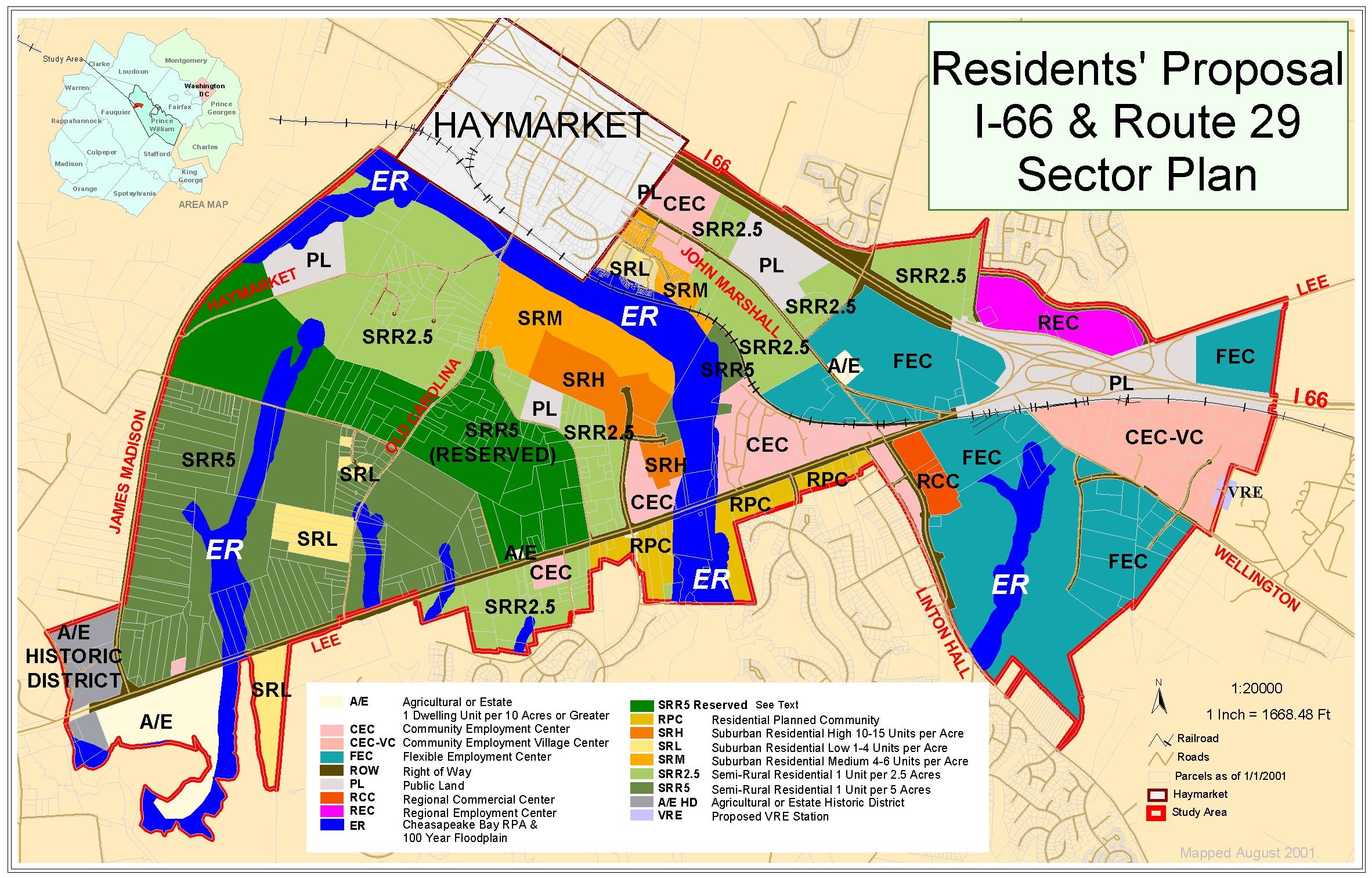
Gainesville Sector Plan
Residents Proposal
Impaired Waterways - Prince William County
2004
2008
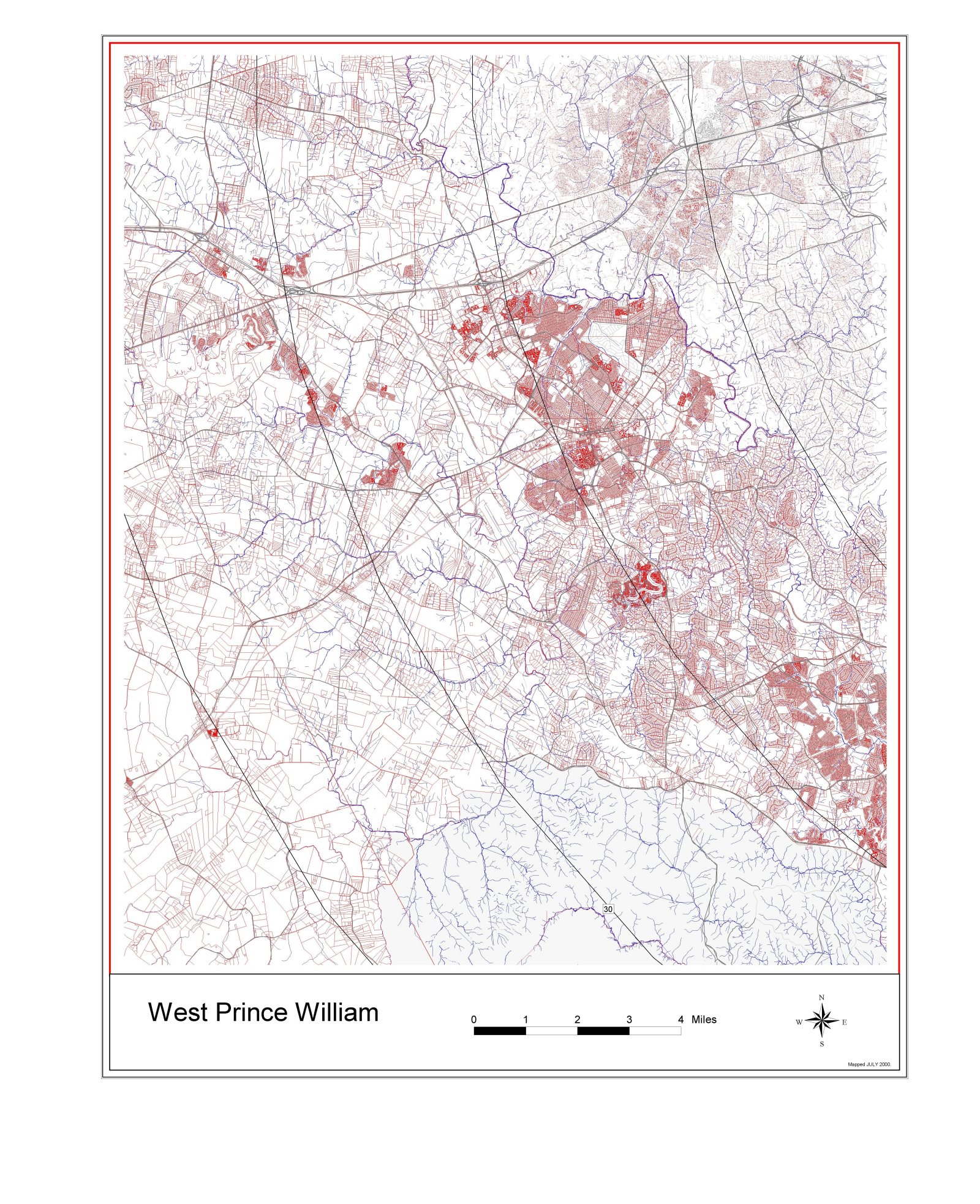
Land parcels - western Prince William County
Land parcels - eastern Prince William County
Use Value Asssessment Program - 2016 properties enrolled
Merrimac Farm Wildlife Management Area
Aerial
Another Aerial
Area Conservation Resources
Soils
Wetlands
Bluebird Trail
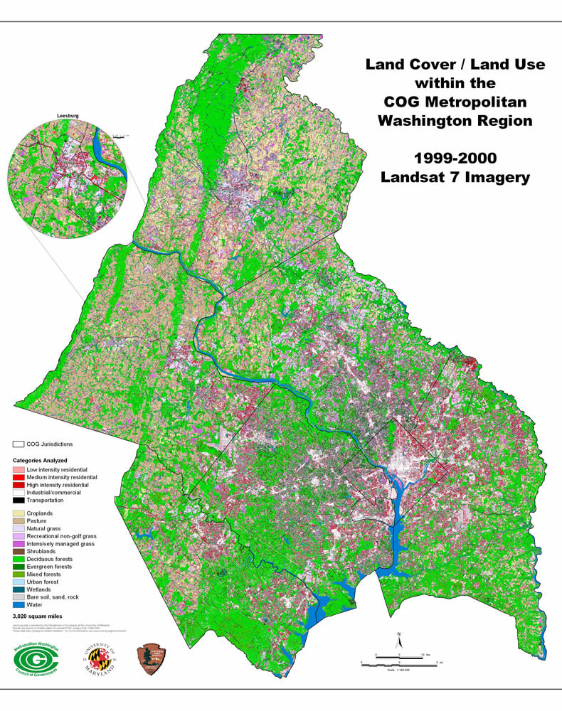
MWCOG Land Cover - 2000
Prince William County Land Cover
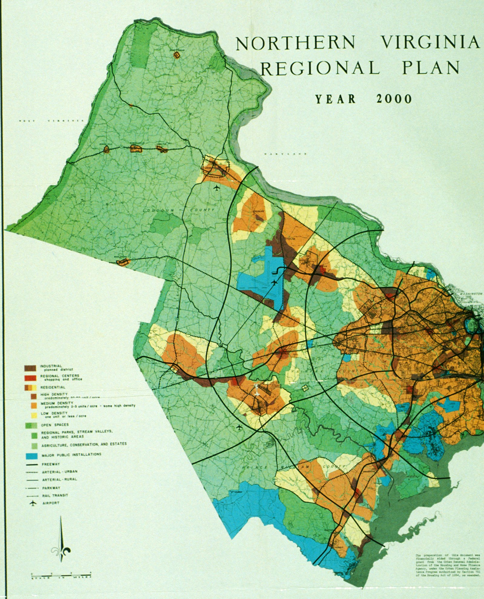
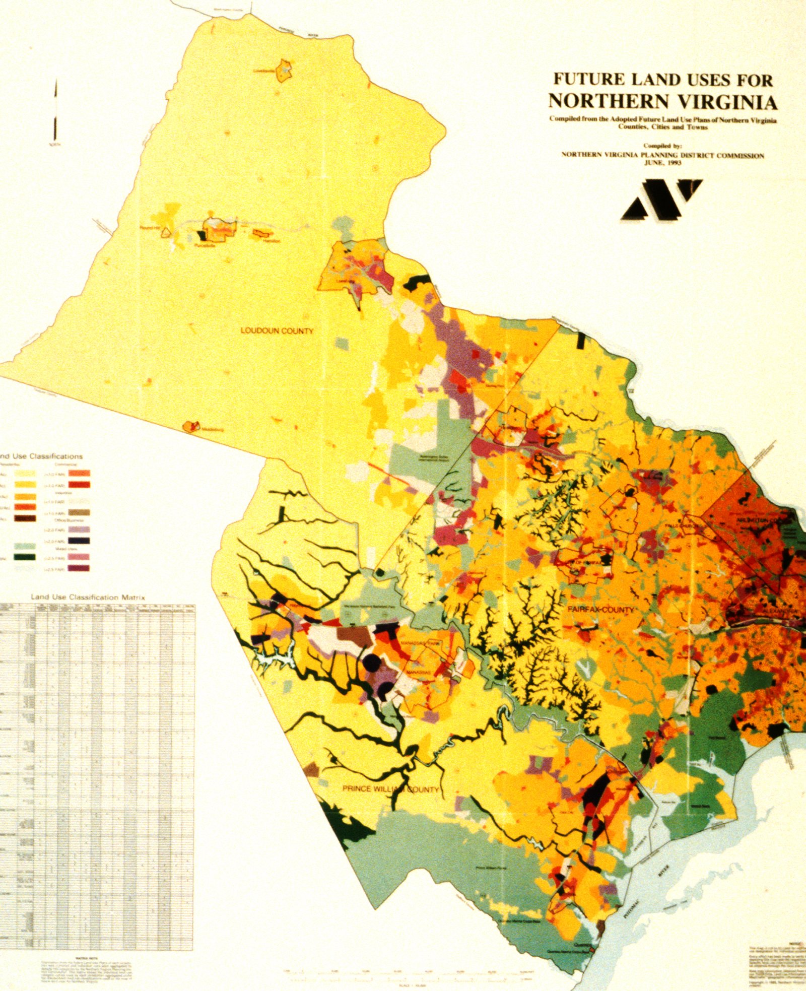
Northern Virginia Regional Plans
1965
1993
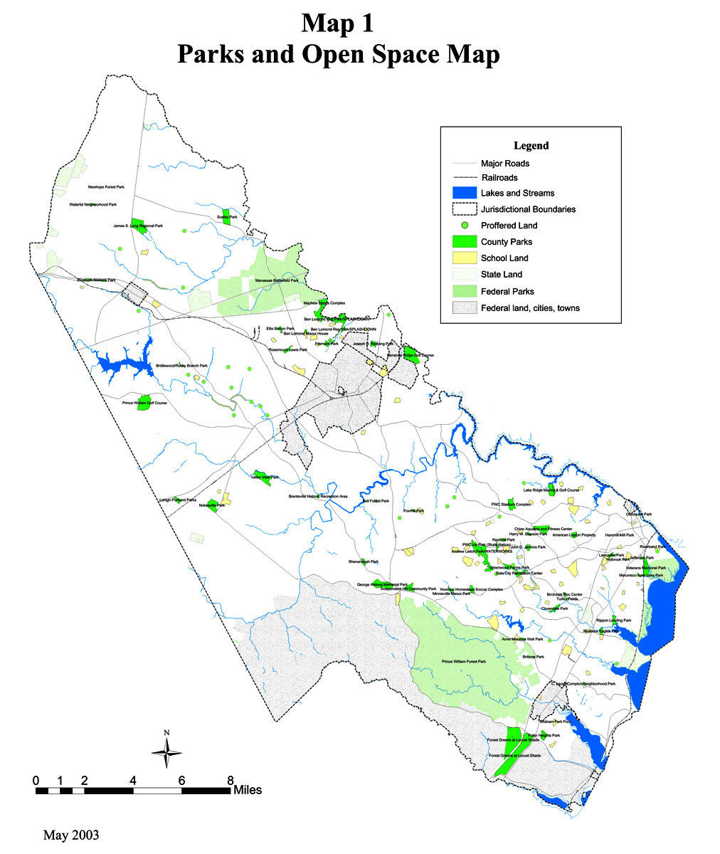
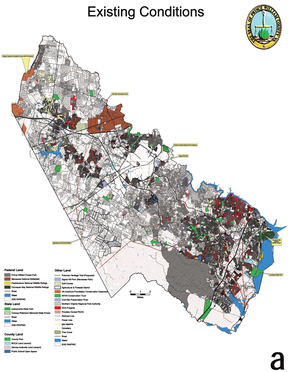
Parks & Open Space
Prince William County, 2003
Existing Conditions, Prince William County, 2007
Dove's Landing Soils Map
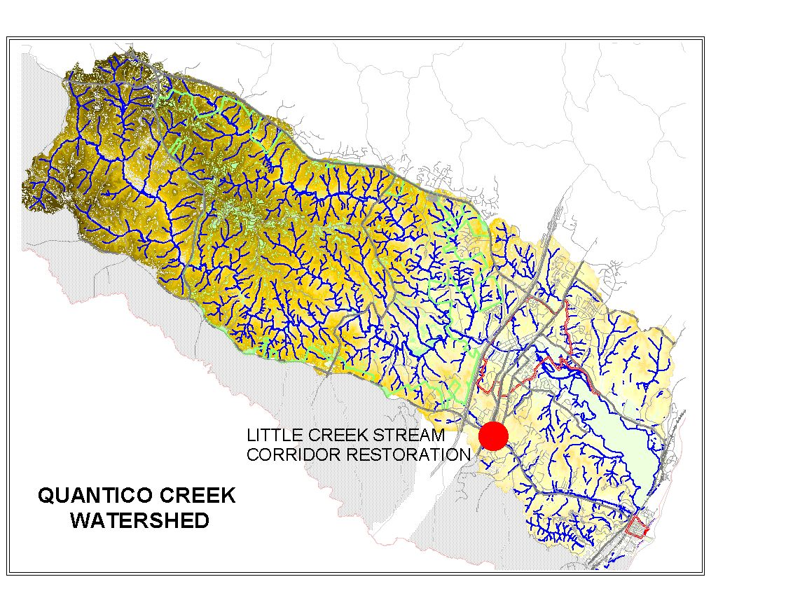
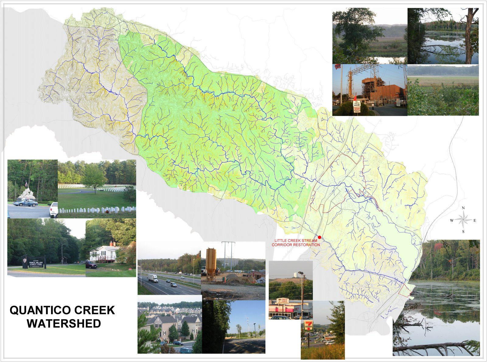
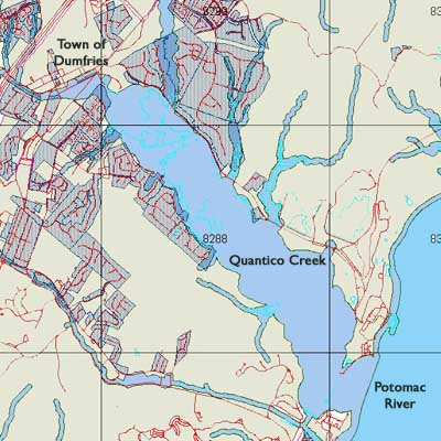
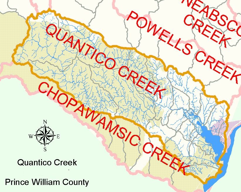
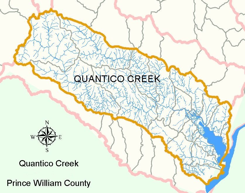
Quantico Creek
Stream restoration
Quantico Creek
(large version)
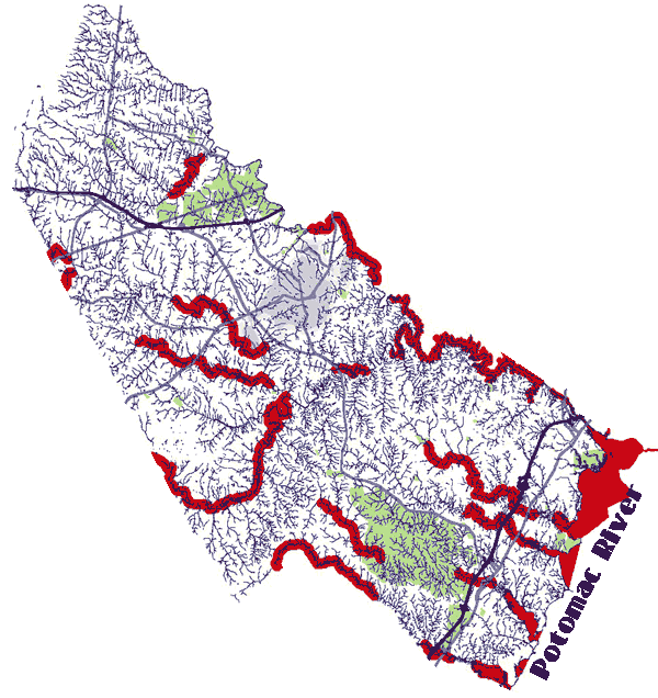
Resource Preservation Area
Resource Preservation Areas
Prince William County
Quantico Creek
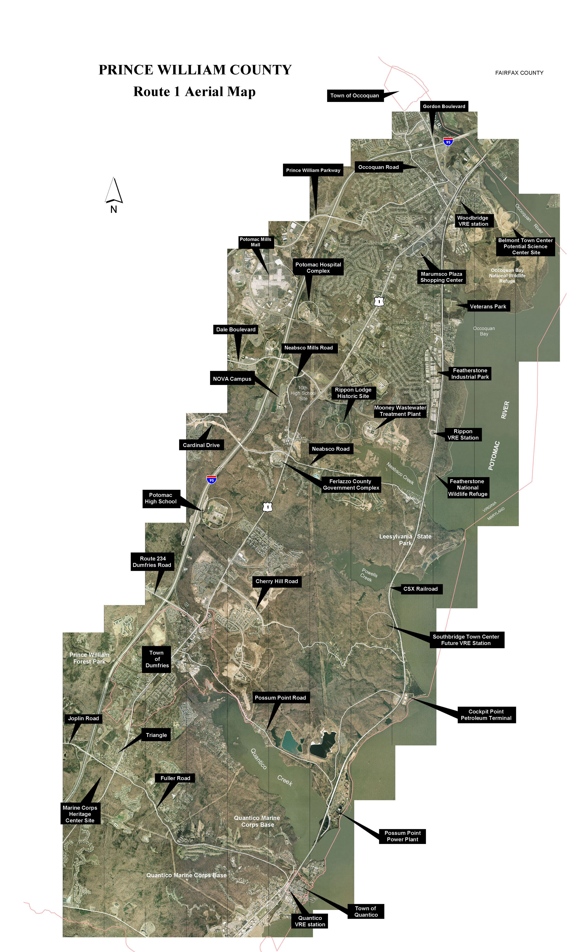
Route 1 - Aerial Map
Rural Crescent - Prince William County
Rural Crescent showing Scenic Byways
Rural Character Map - Draft July 2018
Rural Crescent Showing Proposed Transitional Ribbon Area
Large Properties - 20+ acres and 50+ acres
Properties in the Use Value Assessment Program
Schools
PWC 12th High School site plan map
Silver Lake
Master Plans - Park Authority March 2010 proposals
Aerial
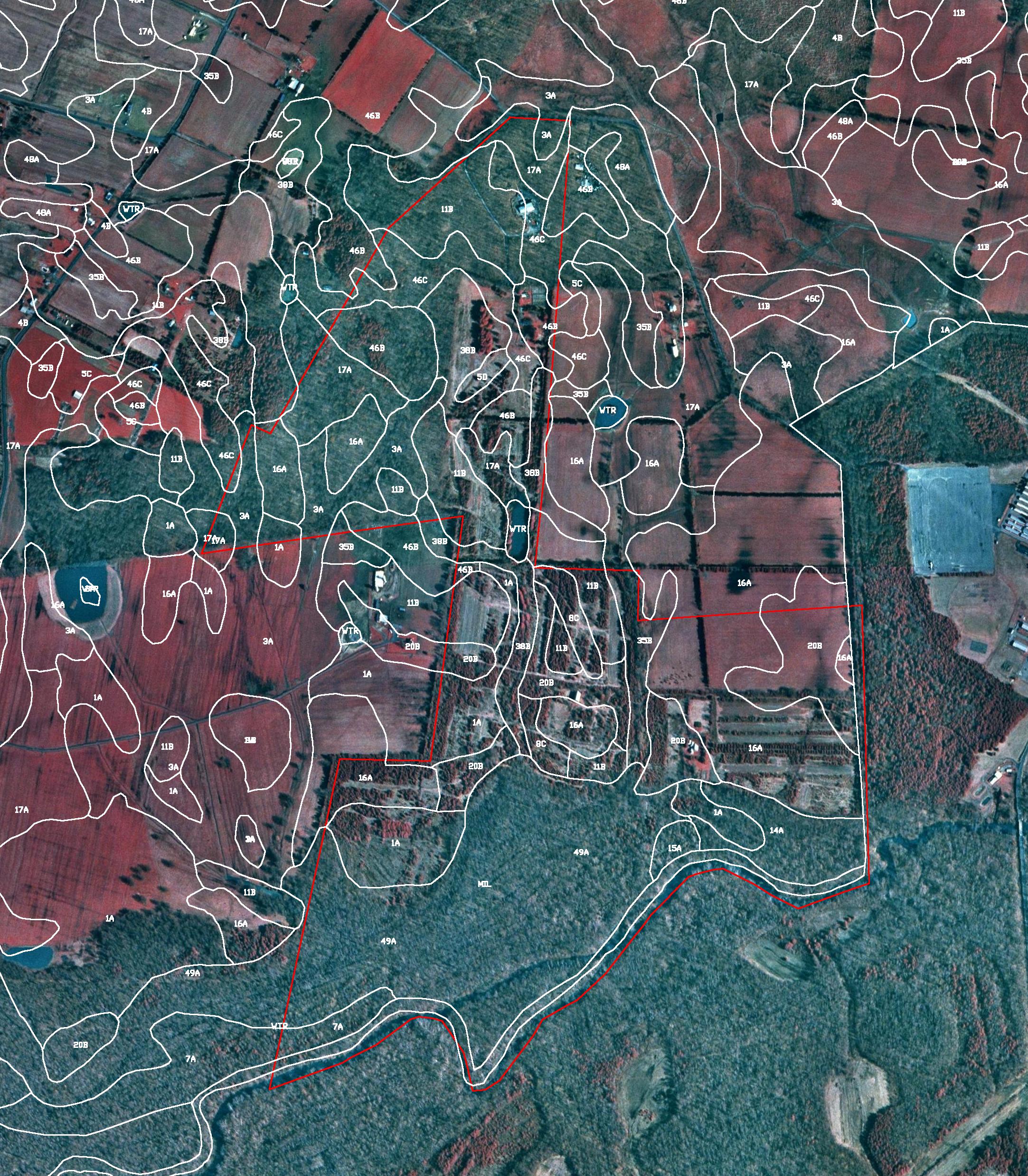
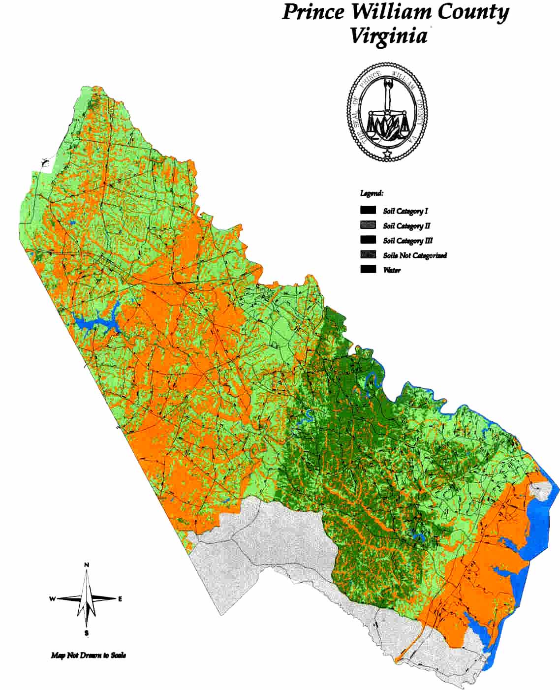
Soil Map - Prince William County
Soil Map Prime Farmland and Forests - Prince William County
Transportation
Blueprint for Better Transportation in Northern Virginia
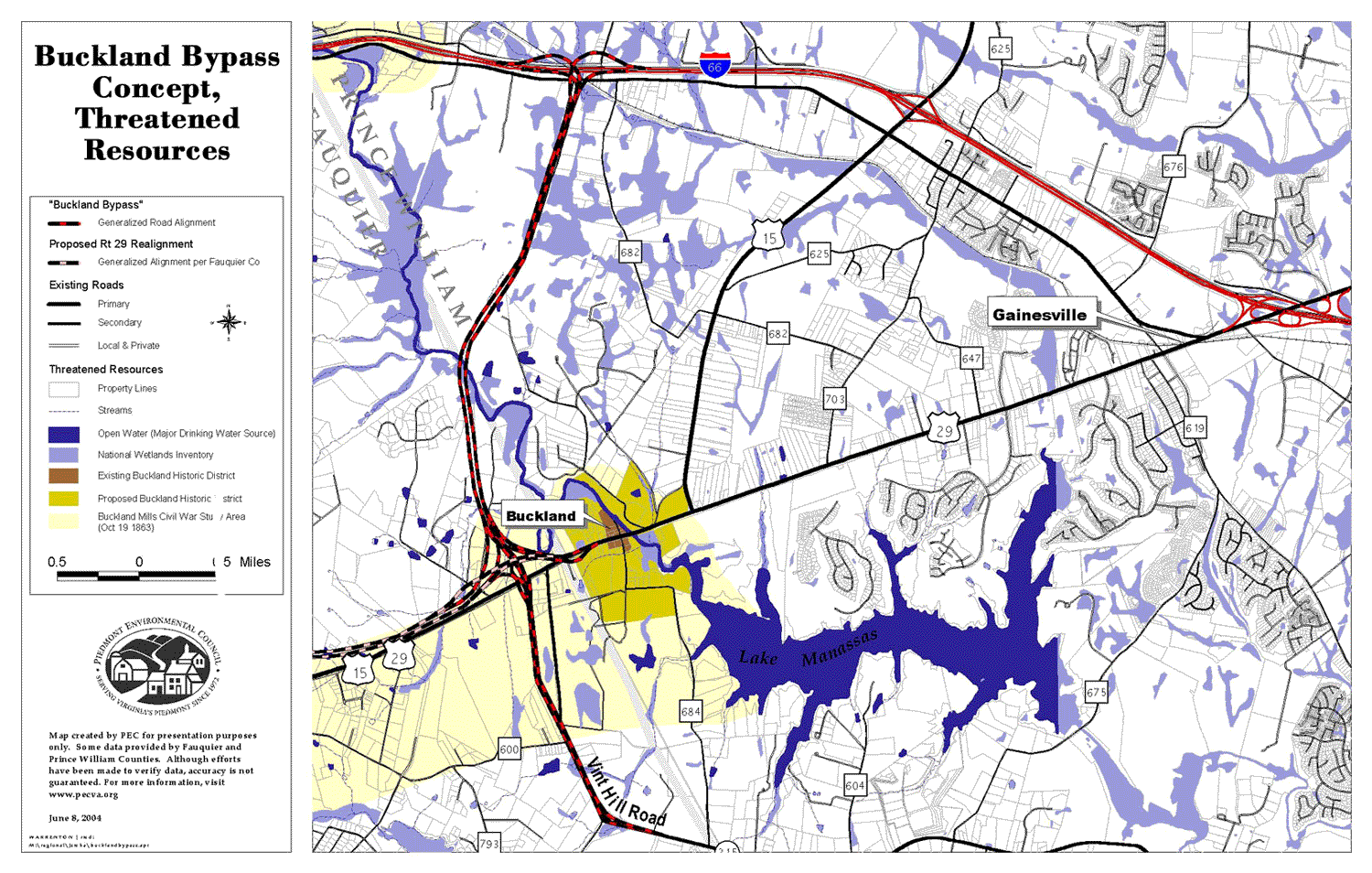
Buckland Bypass Concept
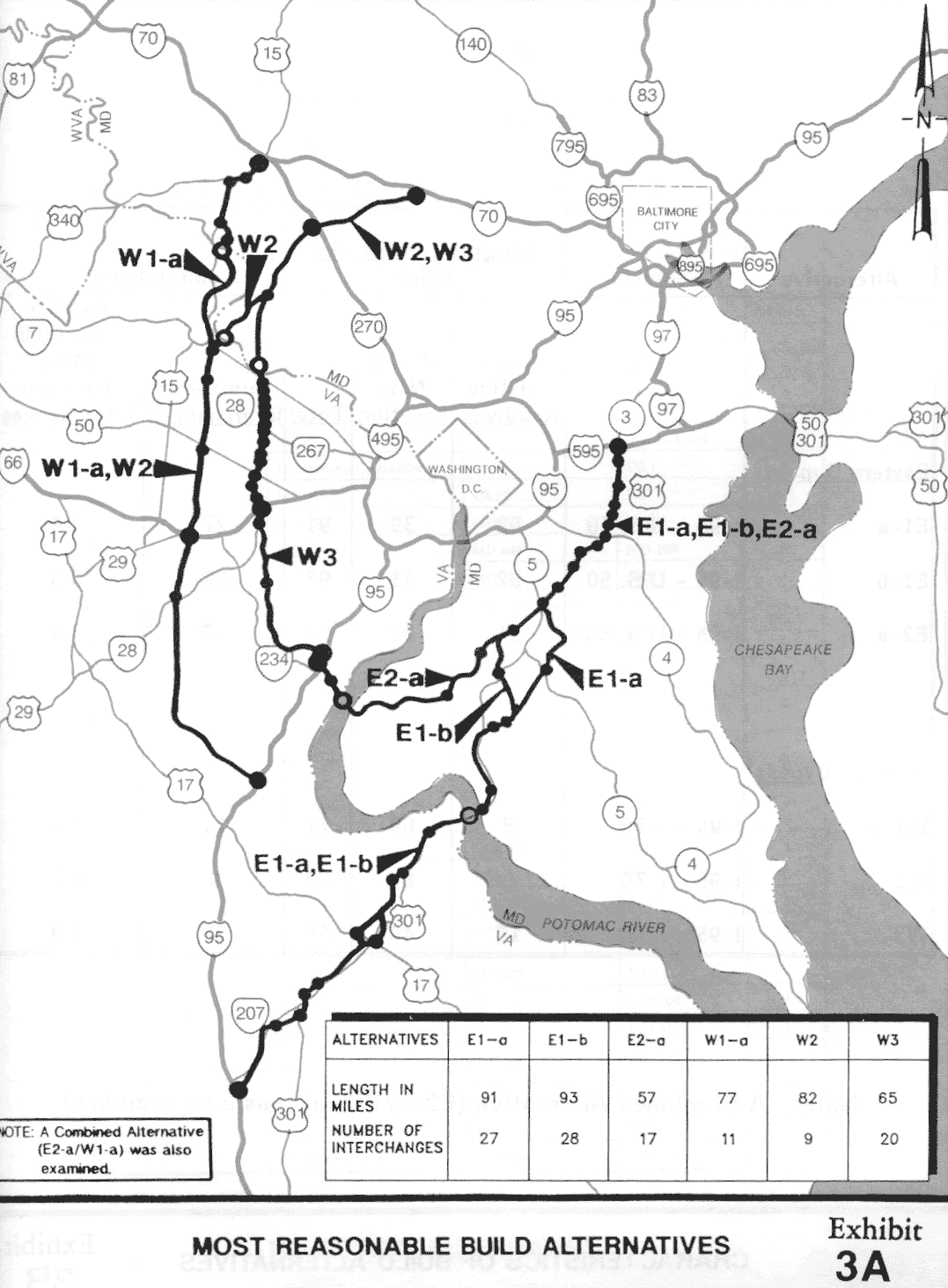
Eastern Crossing Build Alternatives, 1990 study
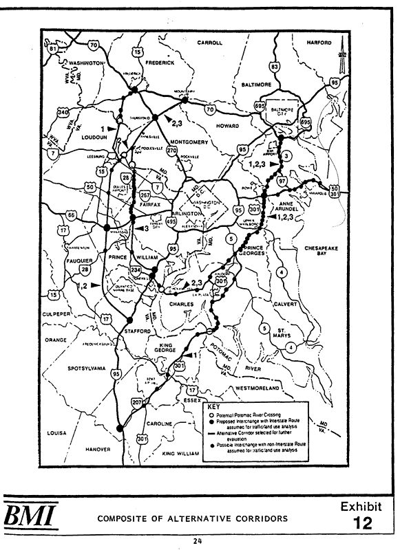
Eastern Crossing Composite of Alternative Corridors
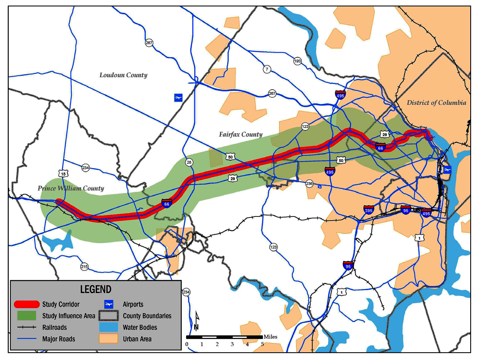
I-66 Transportation Demand Management Study
; VA Dept. of Rail and Public Transportation; May 2009
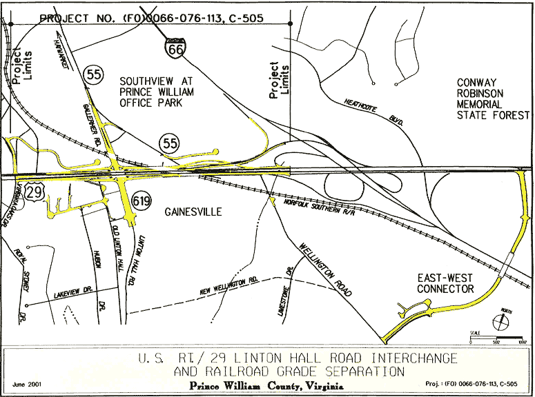
Linton Hall/Rte 29 Interchange and East-West Connector, VDOT Plan
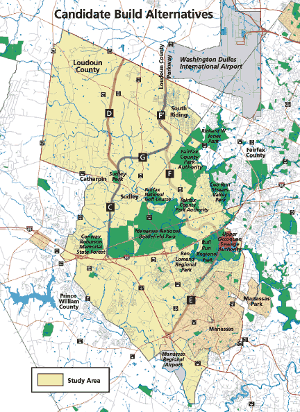
Tri-County Parkway Build Alternatives
Washington Bypass Study, Eastern Crossing
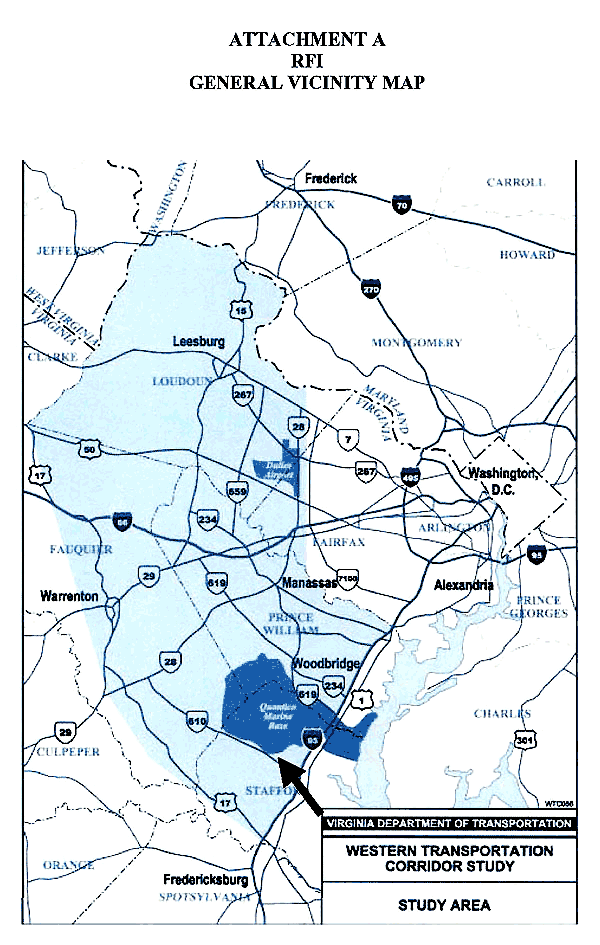
Western Transportation Corridor Study Area
Trails
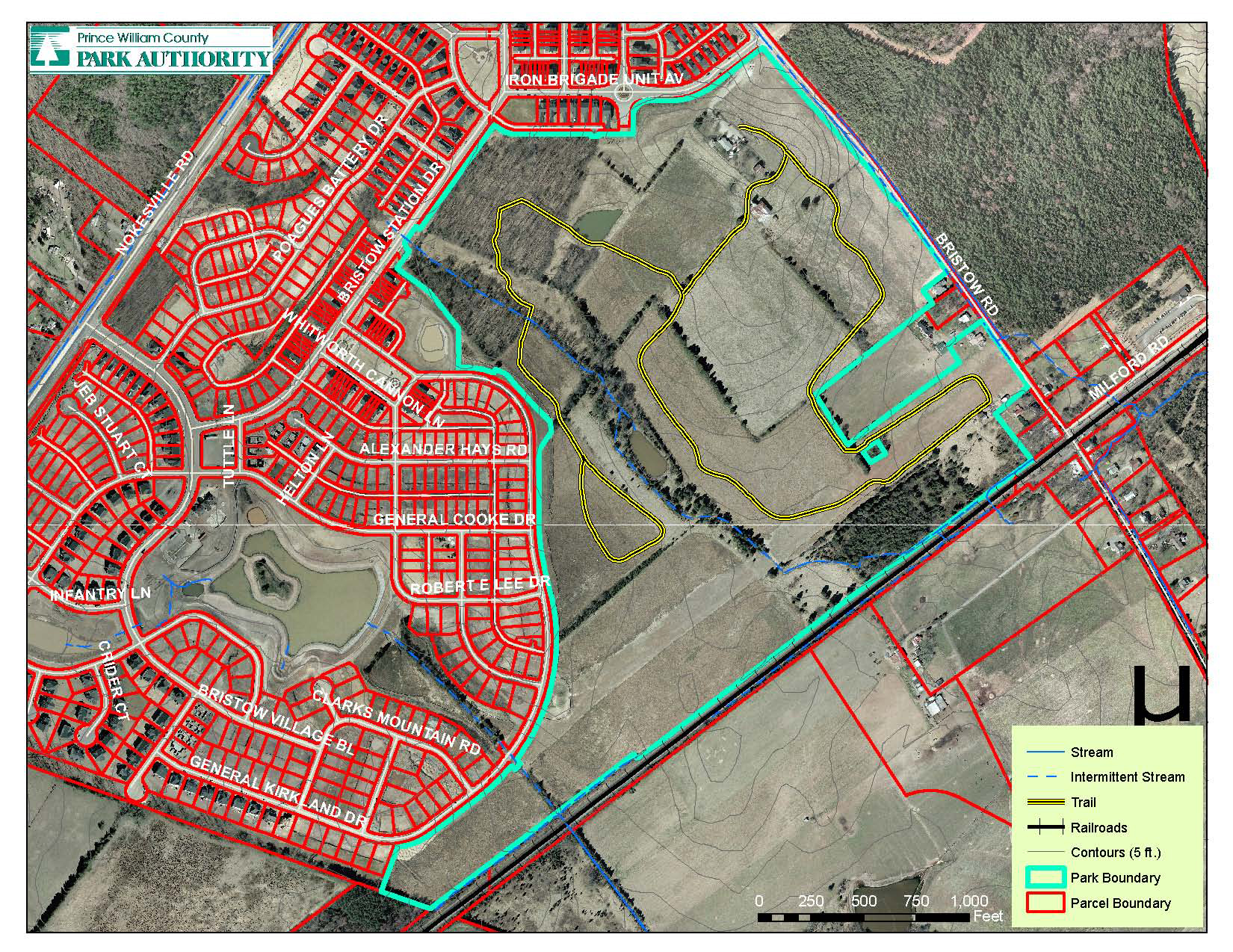
Bristoe Battlefield
Hellwig Park
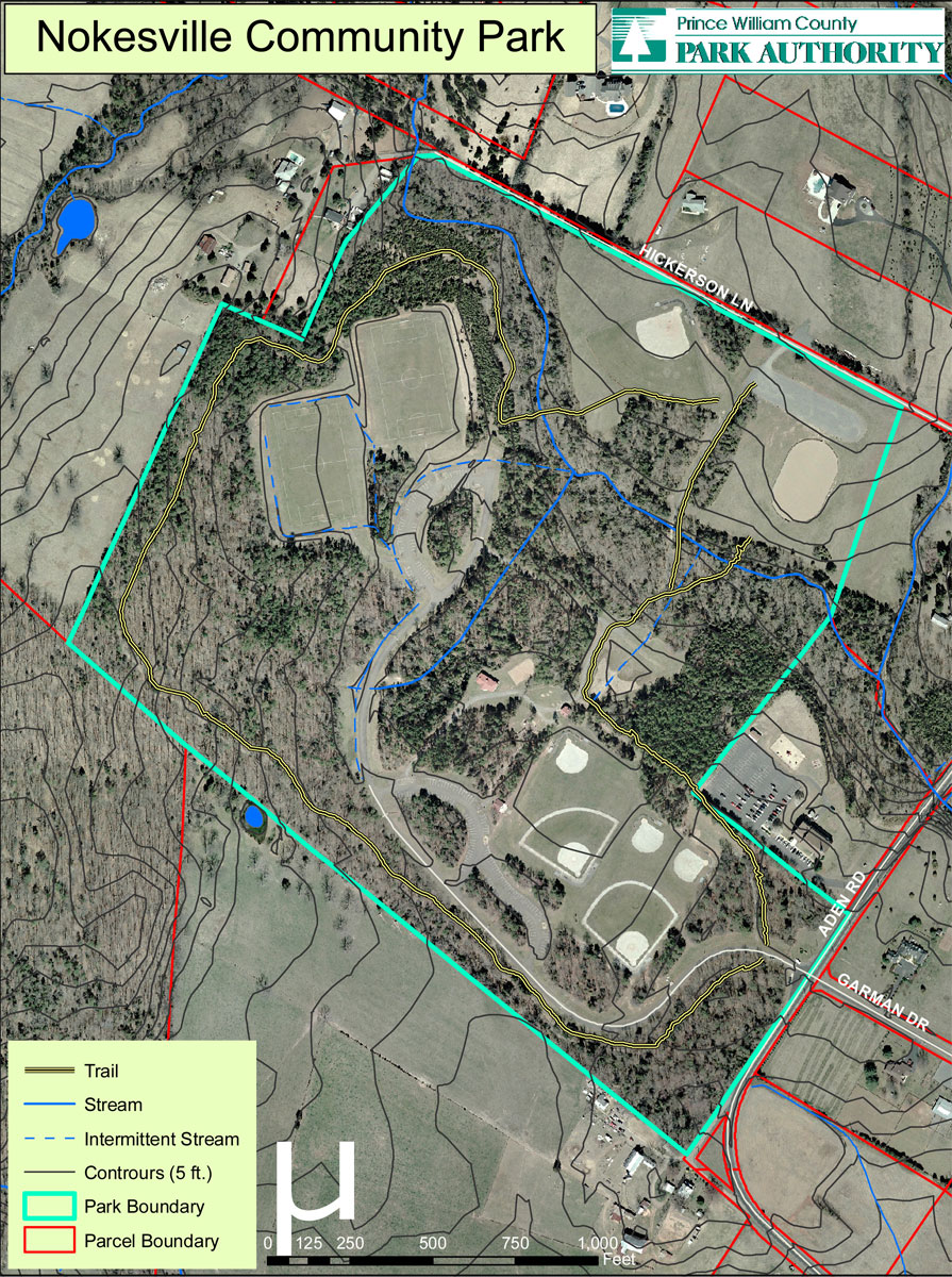
Nokesville Park
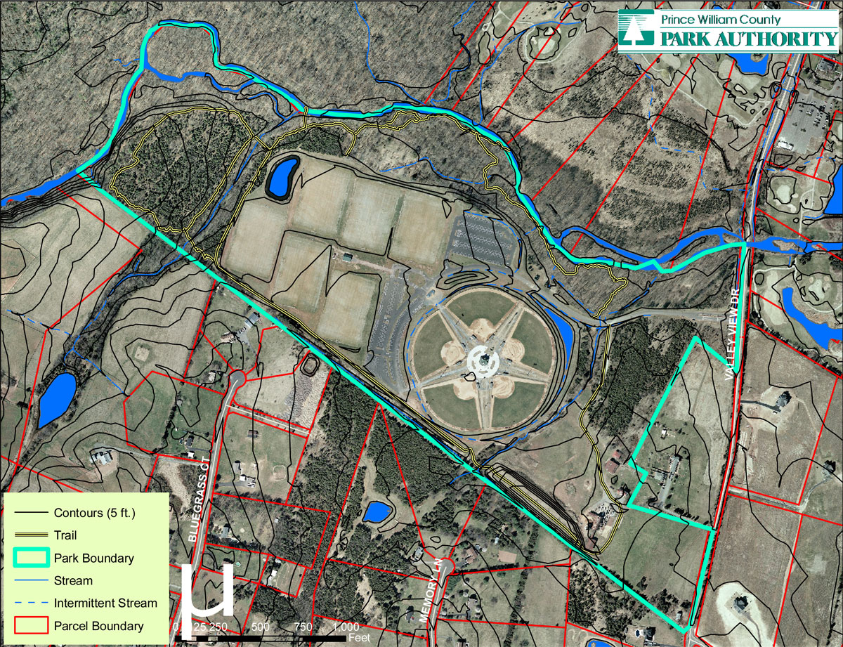
Valley View Park
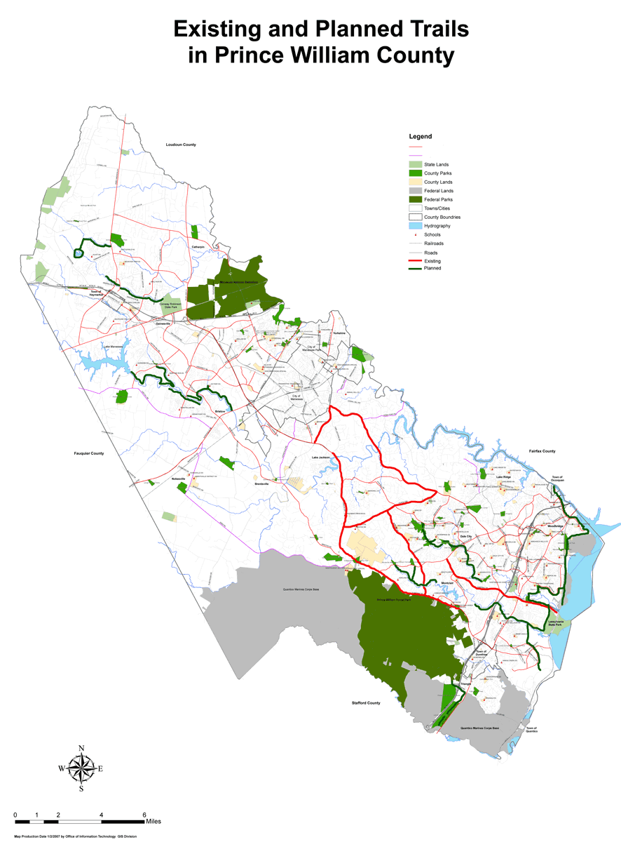
Existing and Planned in Prince William County, 2007
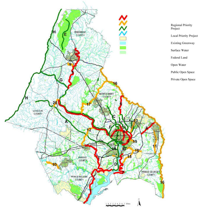
Metropolitan Washington Council of Goverments Planned Corridors
Associated MWCOG Report
Occoquan Greenway Trail
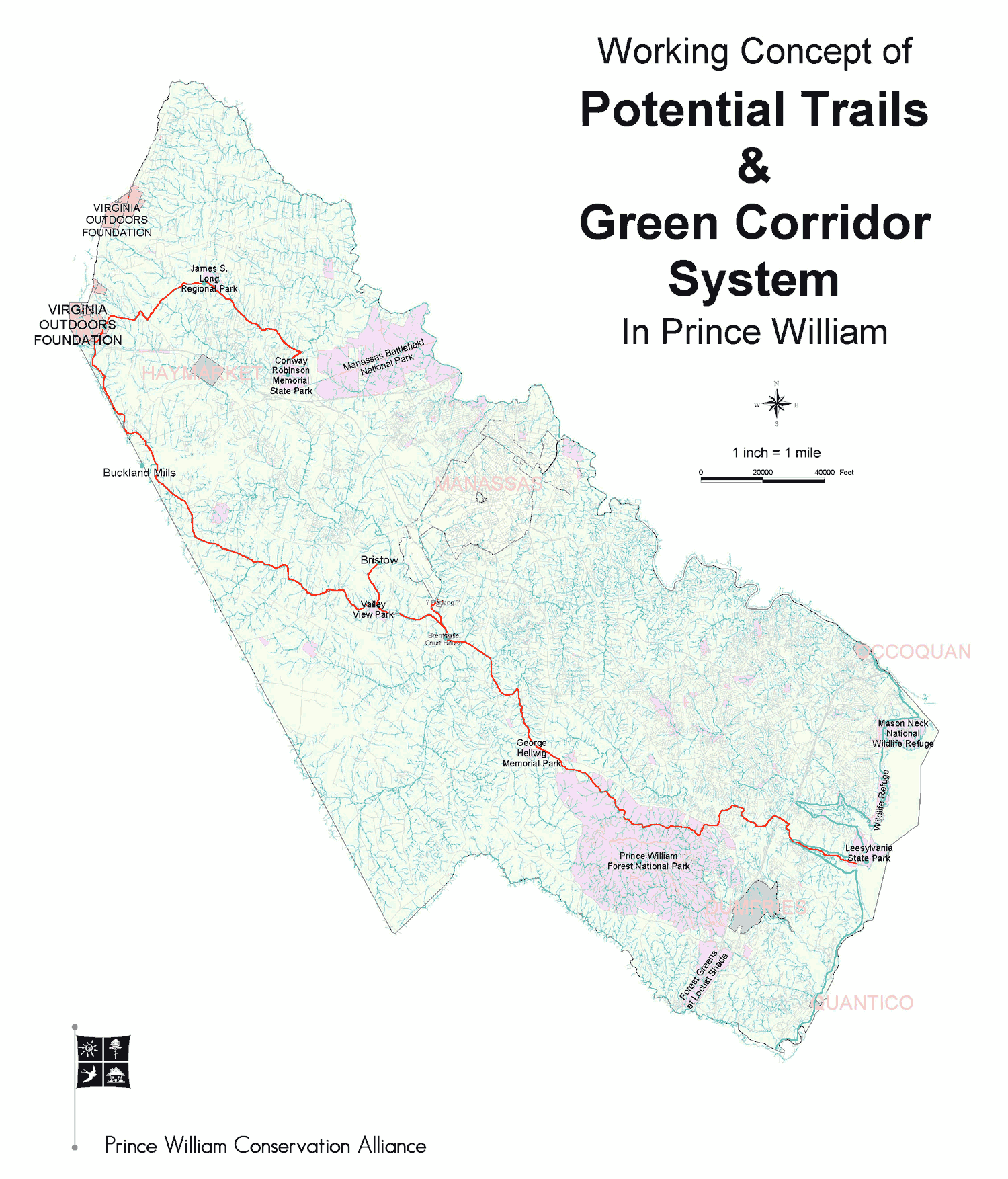
Potential in Prince William County
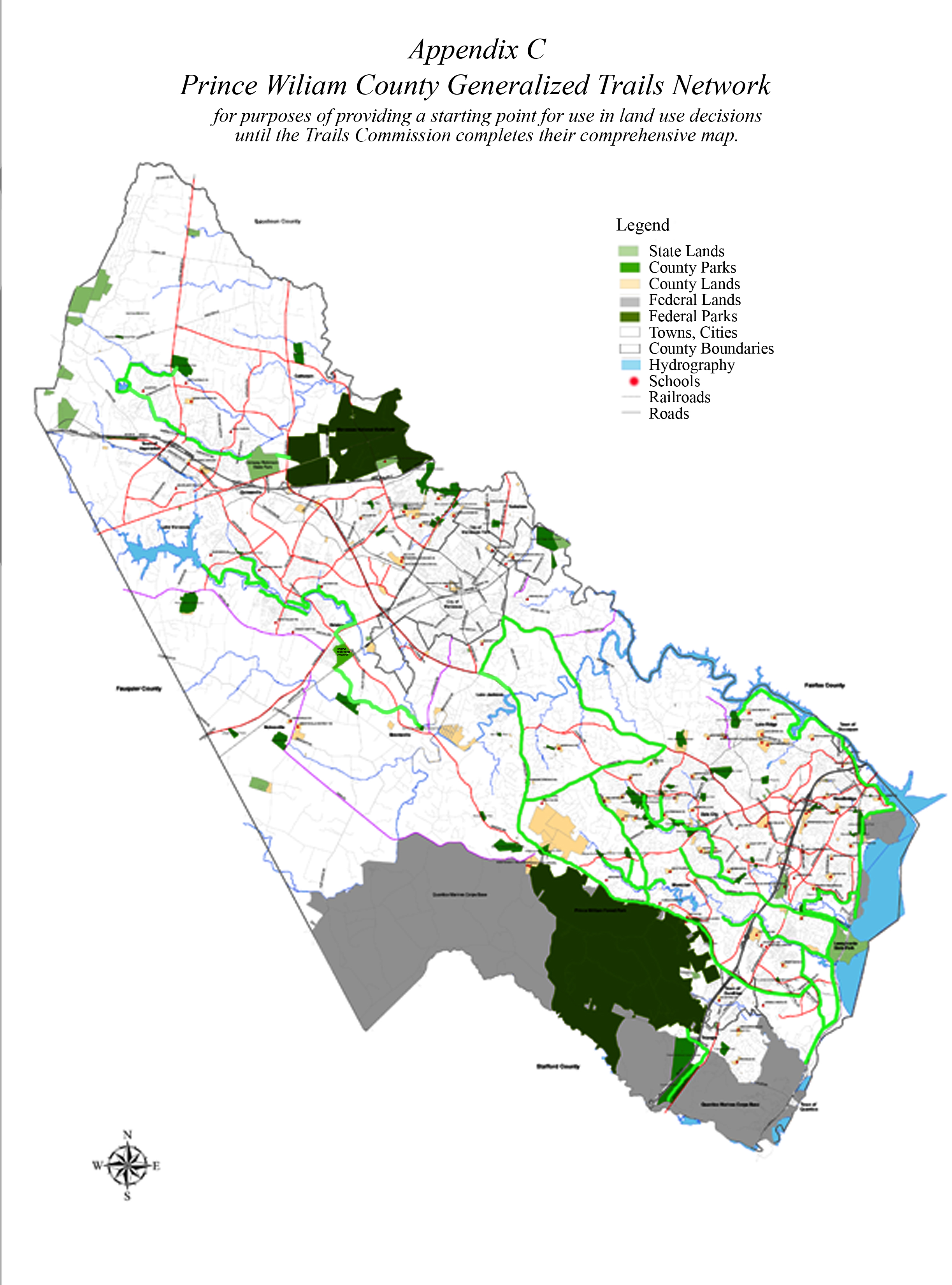
Prince William County Generalized Trail Network, 2007
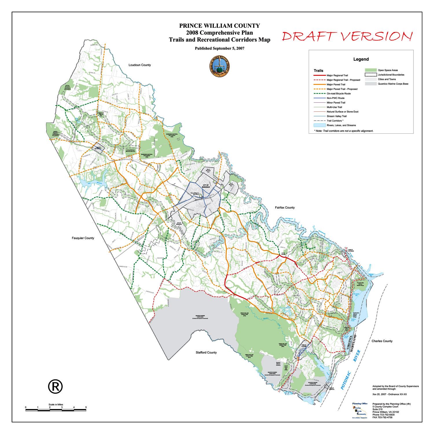
Prince William County Draft Plan for the 2007 Comprehensive Plan Update
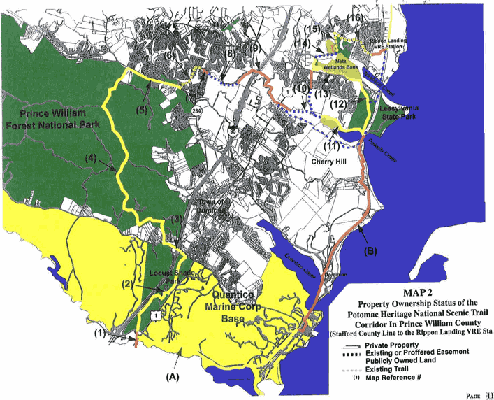
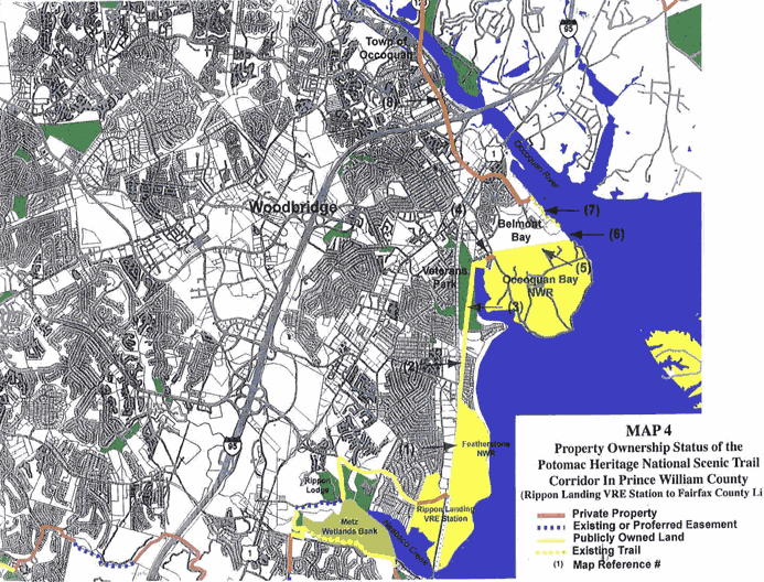
Potomac Heritage in Prince William County, Map 1
Potomac Heritage in Prince William County, Map 2
Virginia GAP - Underprotected Species Richness
Waterfront - Prince William County Topo
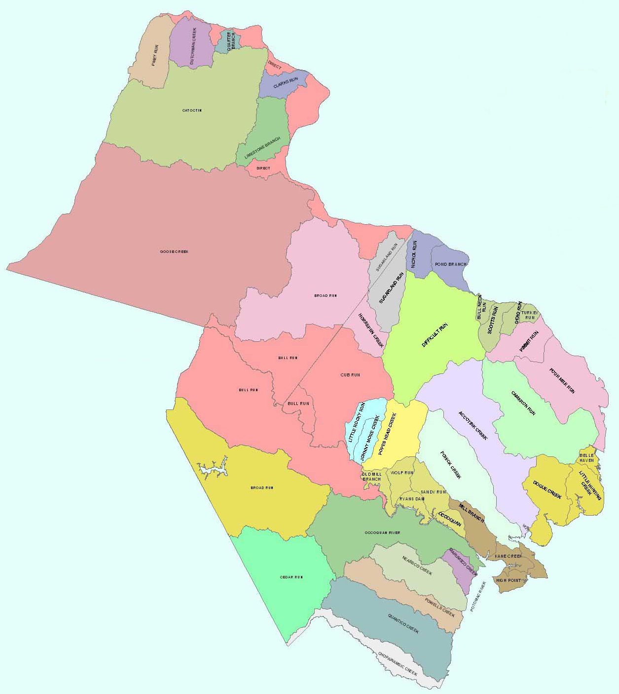
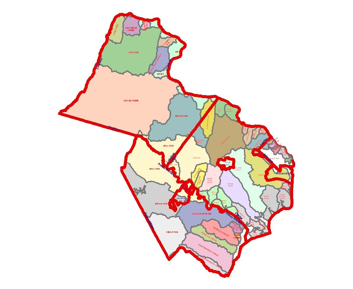
Watersheds & Waterways
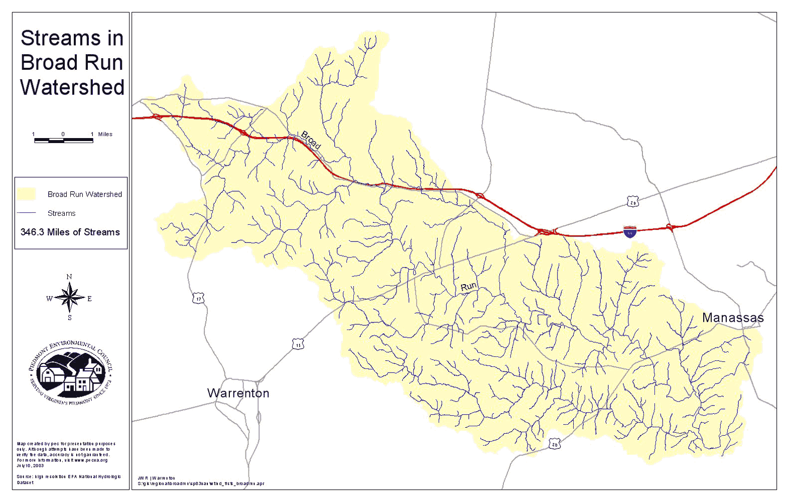
Broad Run
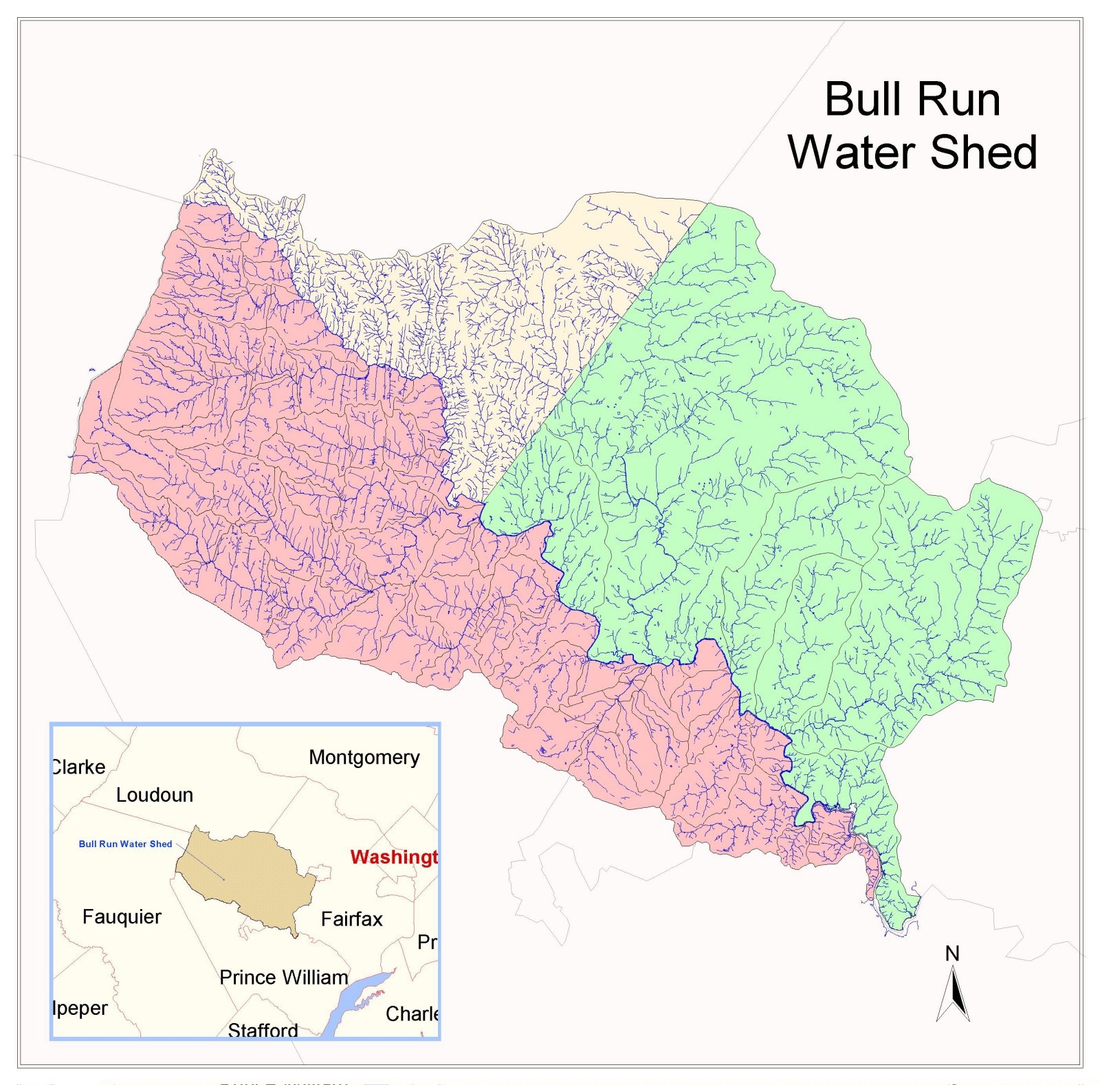
Bull Run
Impaired Streams Prince William County - July 2009
Prince William County 2004 Dirty Waters
Impaired Streams Prince William County
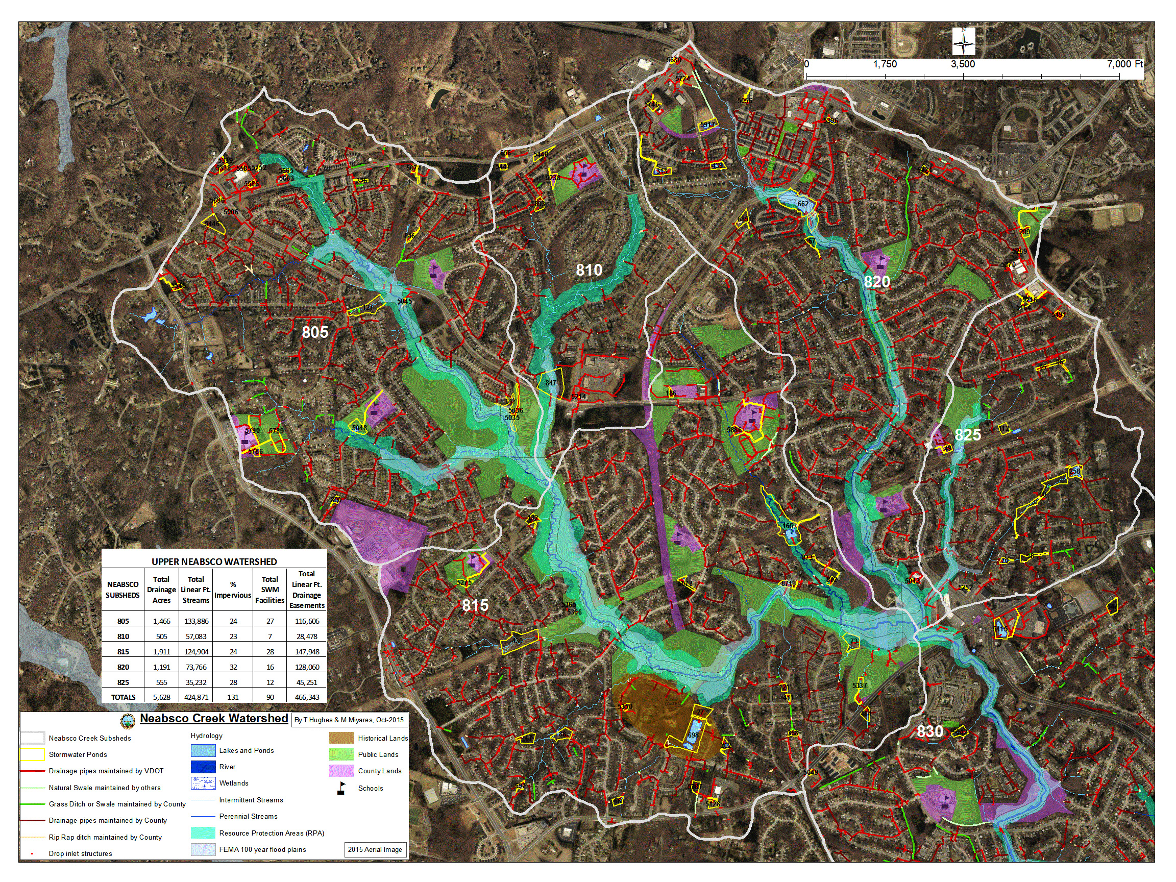
Neabsco Creek -
Small Map
or
Large Map
Northern Virginia
Northern Virginia 2
Northern Virginia 3
Northern Virginia 4
Occoquan Basin
Occoquan
(large version)
Occoquan 2
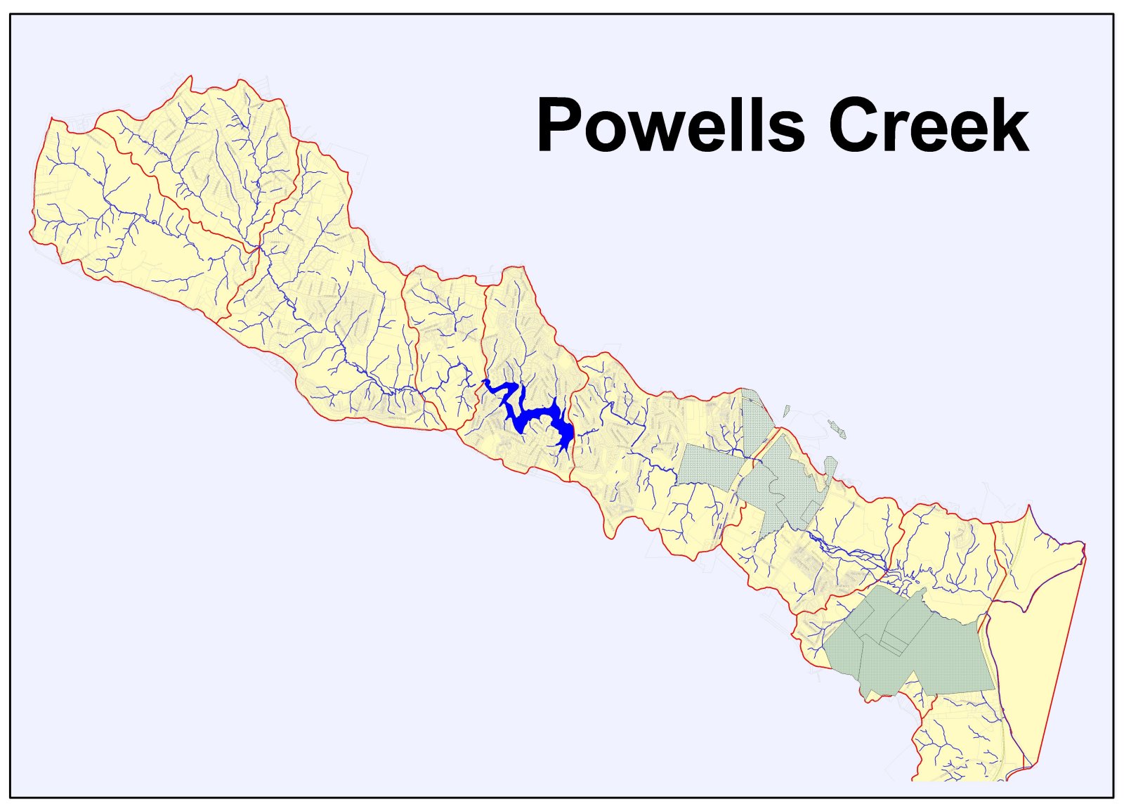
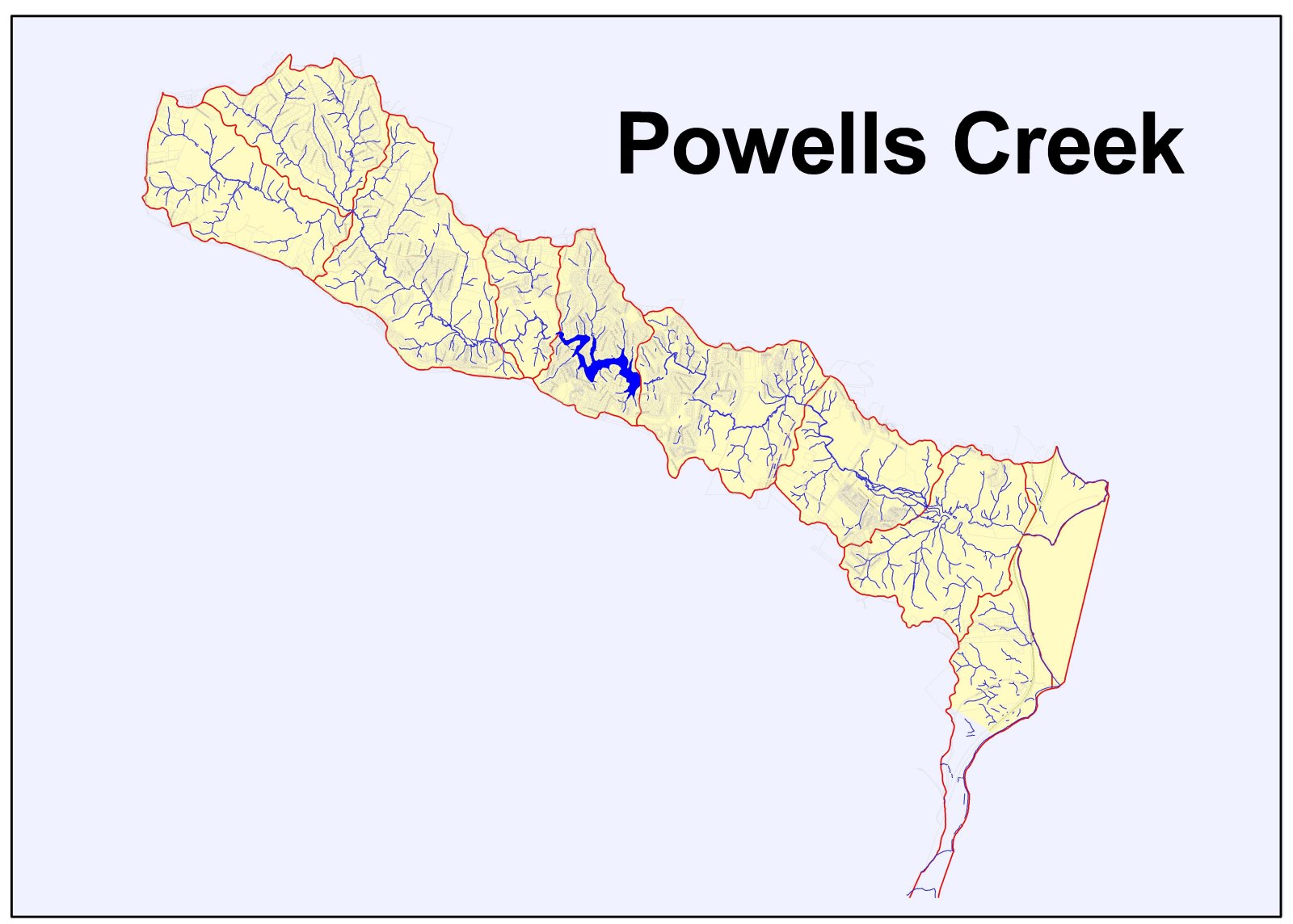
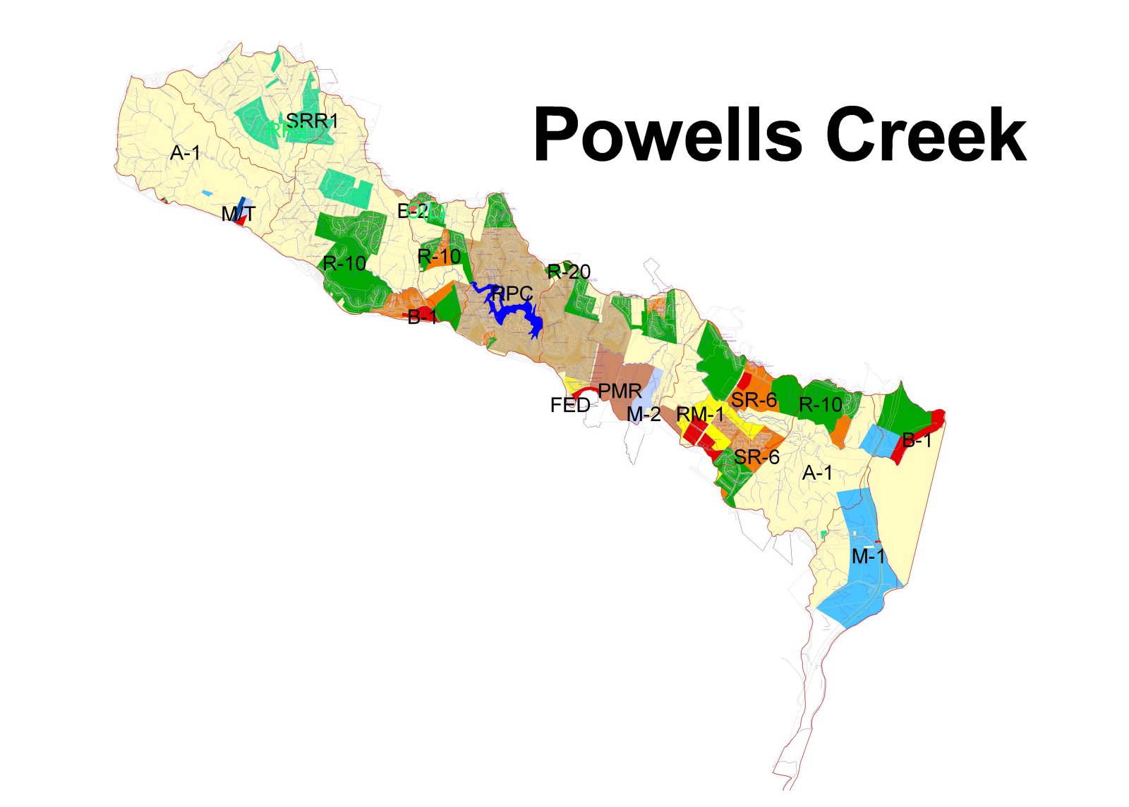
Powell's Creek
Powell's Creek 2
Powell's Creek 3
Prince William County
Quantico Creek
Quantico Creek
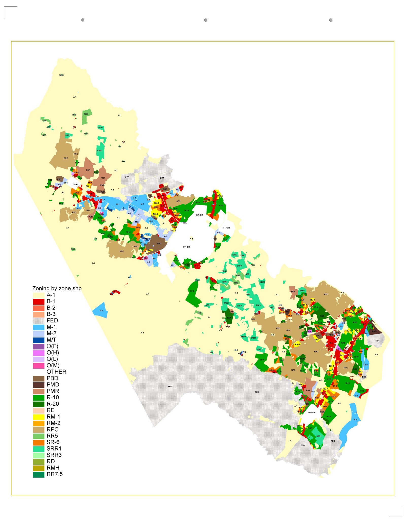
Zoning
Zoning by Rippon VRE station
Home
|
Calendar
|
About Us
|
Resources
|
Local Contacts
Maps
|
Youth Education
|
Membership


