Route 29 Small Area Plan – Status Report
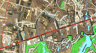
 September, 2017 -- Selected parcels along Route 29, from near Wegman’s to North Fork, may get re-planned to allow for increased residential and commercial development. September, 2017 -- Selected parcels along Route 29, from near Wegman’s to North Fork, may get re-planned to allow for increased residential and commercial development.
The Prince William County Planning Department invited a few “stakeholders” to a meeting on September 21 to launch the “Route 29 Small Area Plan.” Information online now is sparse, but a public Town Hall/Charrette is scheduled tentatively for November 4, 2017.
The trigger for initiating the Route 29 Small Area Plan was the submission of several proposals to develop parcels designated Commercial Employment Center (CEC) in the current Comprehensive Plan for primarily residential use.
Since the General Assembly changed the rules on proffers in 2016, the county is no longer allowed to even suggest developers should help to pay for off-site impacts of new residential development, such as highway interchange improvements or expanded schools.
There is one loophole, however. Proffers can still be requested for a “Small Area Plan” if:
- it is designated a revitalization area
- includes mass transit
- creates mixed use development, with commercial, office, and residential uses
- allows a commercial density of at least 3.0 Floor Area Ratio (FAR), which requires multiple story buildings.
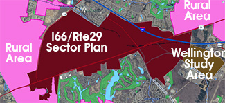
 Charlie Grymes, chair of the Prince William Conservation Alliance, attended as an invited stakeholder. He questioned the process of preparing the Route 29 Small Area Plan independent of any update to the both the I-66/Route 29 (Gainesville) Sector Plan and ongoing updates proposed for multiple chapters Charlie Grymes, chair of the Prince William Conservation Alliance, attended as an invited stakeholder. He questioned the process of preparing the Route 29 Small Area Plan independent of any update to the both the I-66/Route 29 (Gainesville) Sector Plan and ongoing updates proposed for multiple chapters
According to the Planning Office, a later revision to another section of Route 29, closer to I-66, might allow the county to eliminate the I-66-Route 29 (Gainesville) Sector Plan entirely.
Assuming the county holds a Town Meeting in November, the following points should be considered:
-
The county is under no obligation to rezone, but could incentivize landowners to create a common development plan by identifying where road, trail, and sewer infrastructure should be built
-
Cluster development could make sense in this particular area, even without any density increases, to establish frontage roads with a limited number of new intersections
-
If the area was replanned for greater residential development, new parks within walking distance of new residences would need to be acquired in the area
-
A network of trails would be needed for bike/pedestrian access to parks and schools, and Safe Routes to Schools should be incorporated in the planning from the beginning
-
Public access to Lake Manassas should be planned, in anticipation of the city re-opening it to recreational use
-
The potential for transit and traffic demand management to reduce demand for more highway infrastructure should be examined in the planning, rather than just assume that adding capacity was the only solution
-
The county should determine the ability of Dominion/NOVEC to service more customers in the area without needing more transmission lines
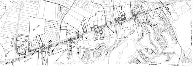
One challenge on route 29 that that each of the individual parcels has legal access to Route 29. VDOT has proposed an access management plan eliminating crossovers on the divided highway, and VDOT later sent a copy to the Prince William Conservation Alliance (see below).
 |


